
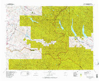
~ Snoqualmie Pass WA topo map, 1:100000 scale, 30 X 60 Minute, Historical, 1975, updated 1977
Snoqualmie Pass, Washington, USGS topographic map dated 1975.
Includes geographic coordinates (latitude and longitude). This topographic map is suitable for hiking, camping, and exploring, or framing it as a wall map.
Printed on-demand using high resolution imagery, on heavy weight and acid free paper, or alternatively on a variety of synthetic materials.
Topos available on paper, Waterproof, Poly, or Tyvek. Usually shipping rolled, unless combined with other folded maps in one order.
- Product Number: USGS-5411034
- Free digital map download (high-resolution, GeoPDF): Snoqualmie Pass, Washington (file size: 44 MB)
- Map Size: please refer to the dimensions of the GeoPDF map above
- Weight (paper map): ca. 55 grams
- Map Type: POD USGS Topographic Map
- Map Series: HTMC
- Map Verison: Historical
- Cell ID: 68382
- Scan ID: 243834
- Imprint Year: 1977
- Aerial Photo Year: 1973
- Datum: NAD27
- Map Projection: Universal Transverse Mercator
- Map published by United States Geological Survey
- Map Language: English
- Scanner Resolution: 600 dpi
- Map Cell Name: Snoqualmie Pass
- Grid size: 30 X 60 Minute
- Date on map: 1975
- Map Scale: 1:100000
- Geographical region: Washington, United States
Neighboring Maps:
All neighboring USGS topo maps are available for sale online at a variety of scales.
Spatial coverage:
Topo map Snoqualmie Pass, Washington, covers the geographical area associated the following places:
- Page - Snoquera - Cedar Falls - Barneston - Franklin - Snoose Junction - Edgewick - Lester - Mount Si Mobile Home Park - Easton - Misty Mountain Mobile Home Park - Circle H Mobile Home Park - Hyak - Upper Mill - Landsburg - Maywood - Snoqualmie Pass - Kanaskat Junction - Garcia - Humphrey - Harman Heights - Veazie - Bayne - Palmer - Whittier - Trude - Pine Glen - North Bend - Kerriston - Kanaskat - Cabin Creek - Birch - Mirrormont - Palmer Junction - Cougar Valley - Greenwater - Rockdale - Nagrom - Tanner - Nelson - Martin - Ragnar - Denny Creek - Bayne Junction - Lavender - Kachess Resort - Ravensdale - Selleck - Naco - Riverbend - Mountain Meadows Manufactured Home Community - Durham - Kangley - Hobart - Crystalaire Mobile Home Park - Krain - Bagley Junction - Cumberland - Lemolo - Enumclaw - Mountain Villa Mobile Manor - Georgetown - Ronald - Stampede - Bandera - Lakedale - Driftwood Acres
- Map Area ID: AREA47.547-122-121
- Northwest corner Lat/Long code: USGSNW47.5-122
- Northeast corner Lat/Long code: USGSNE47.5-121
- Southwest corner Lat/Long code: USGSSW47-122
- Southeast corner Lat/Long code: USGSSE47-121
- Northern map edge Latitude: 47.5
- Southern map edge Latitude: 47
- Western map edge Longitude: -122
- Eastern map edge Longitude: -121


