
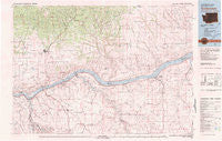
~ Goldendale WA topo map, 1:100000 scale, 30 X 60 Minute, Historical, 1980, updated 1981
Goldendale, Washington, USGS topographic map dated 1980.
Includes geographic coordinates (latitude and longitude). This topographic map is suitable for hiking, camping, and exploring, or framing it as a wall map.
Printed on-demand using high resolution imagery, on heavy weight and acid free paper, or alternatively on a variety of synthetic materials.
Topos available on paper, Waterproof, Poly, or Tyvek. Usually shipping rolled, unless combined with other folded maps in one order.
- Product Number: USGS-5410976
- Free digital map download (high-resolution, GeoPDF): Goldendale, Washington (file size: 24 MB)
- Map Size: please refer to the dimensions of the GeoPDF map above
- Weight (paper map): ca. 55 grams
- Map Type: POD USGS Topographic Map
- Map Series: HTMC
- Map Verison: Historical
- Cell ID: 67583
- Scan ID: 241350
- Imprint Year: 1981
- Woodland Tint: Yes
- Aerial Photo Year: 1977
- Edit Year: 1980
- Datum: NAD27
- Map Projection: Universal Transverse Mercator
- Map published by United States Geological Survey
- Map Language: English
- Scanner Resolution: 600 dpi
- Map Cell Name: Goldendale
- Grid size: 30 X 60 Minute
- Date on map: 1980
- Map Scale: 1:100000
- Geographical region: Washington, United States
Neighboring Maps:
All neighboring USGS topo maps are available for sale online at a variety of scales.
Spatial coverage:
Topo map Goldendale, Washington, covers the geographical area associated the following places:
- Locust Grove - Sundale - Warwick - Bates - Sinks (historical) - Emigrant Springs (historical) - Centerville - Pleasant Valley - Emerson - Towal - Moona - Rufus - Goodnoe - Blockhouse - Rock Creek - Bickleton - Firwood - Wasco - Montague (historical) - Wishram Heights - Arlington - McDonald - De Moss Springs - Roosevelt - Celilo Village - Goodnoe Hills - Dot - Thornberry - Maryhill - Klondike - Biggs Junction - Goldendale - Sixprong - Wishram - Early (historical) - Eddy (historical) - Cleveland
- Map Area ID: AREA4645.5-121-120
- Northwest corner Lat/Long code: USGSNW46-121
- Northeast corner Lat/Long code: USGSNE46-120
- Southwest corner Lat/Long code: USGSSW45.5-121
- Southeast corner Lat/Long code: USGSSE45.5-120
- Northern map edge Latitude: 46
- Southern map edge Latitude: 45.5
- Western map edge Longitude: -121
- Eastern map edge Longitude: -120


