
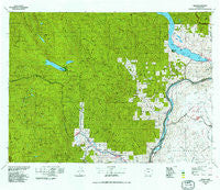
~ Chelan WA topo map, 1:100000 scale, 30 X 60 Minute, Historical, 1975, updated 1991
Chelan, Washington, USGS topographic map dated 1975.
Includes geographic coordinates (latitude and longitude). This topographic map is suitable for hiking, camping, and exploring, or framing it as a wall map.
Printed on-demand using high resolution imagery, on heavy weight and acid free paper, or alternatively on a variety of synthetic materials.
Topos available on paper, Waterproof, Poly, or Tyvek. Usually shipping rolled, unless combined with other folded maps in one order.
- Product Number: USGS-5410952
- Free digital map download (high-resolution, GeoPDF): Chelan, Washington (file size: 45 MB)
- Map Size: please refer to the dimensions of the GeoPDF map above
- Weight (paper map): ca. 55 grams
- Map Type: POD USGS Topographic Map
- Map Series: HTMC
- Map Verison: Historical
- Cell ID: 67279
- Scan ID: 240446
- Imprint Year: 1991
- Woodland Tint: Yes
- Aerial Photo Year: 1973
- Datum: NAD27
- Map Projection: Universal Transverse Mercator
- Map published by United States Geological Survey
- Map Language: English
- Scanner Resolution: 600 dpi
- Map Cell Name: Chelan
- Grid size: 30 X 60 Minute
- Date on map: 1975
- Map Scale: 1:100000
- Geographical region: Washington, United States
Neighboring Maps:
All neighboring USGS topo maps are available for sale online at a variety of scales.
Spatial coverage:
Topo map Chelan, Washington, covers the geographical area associated the following places:
- Chiwaukum - Chumstick - Cashmere - Riverbend Mobile Home Park - Granite Falls - Maplecreek - Greens Landing - Coles Corner - Chelan - Telma - McLeans Orchard (historical) - Merritt - Selfs Trailer Park - Wagnersburg - Town's Mobile Home Park - Nason Creek - Hay Canyon Mobile Home Park - Manson - Stayman - Ardenvoir - Shrine Beach - Berne - Winesap - Hollywood Beach - Lake Chelan Hills - Entiat - Leavenworth - Entiat (historical) - Dawn Lee Mobile Home Court - Sunnybank - Winton - Peshastin - Lakeside - Dryden - Farris - Waterville - Douglas - Plain - Orondo
- Map Area ID: AREA4847.5-121-120
- Northwest corner Lat/Long code: USGSNW48-121
- Northeast corner Lat/Long code: USGSNE48-120
- Southwest corner Lat/Long code: USGSSW47.5-121
- Southeast corner Lat/Long code: USGSSE47.5-120
- Northern map edge Latitude: 48
- Southern map edge Latitude: 47.5
- Western map edge Longitude: -121
- Eastern map edge Longitude: -120


