
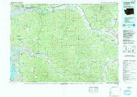
~ Chehalis River WA topo map, 1:100000 scale, 30 X 60 Minute, Historical, 1992, updated 1993
Chehalis River, Washington, USGS topographic map dated 1992.
Includes geographic coordinates (latitude and longitude). This topographic map is suitable for hiking, camping, and exploring, or framing it as a wall map.
Printed on-demand using high resolution imagery, on heavy weight and acid free paper, or alternatively on a variety of synthetic materials.
Topos available on paper, Waterproof, Poly, or Tyvek. Usually shipping rolled, unless combined with other folded maps in one order.
- Product Number: USGS-5410948
- Free digital map download (high-resolution, GeoPDF): Chehalis River, Washington (file size: 34 MB)
- Map Size: please refer to the dimensions of the GeoPDF map above
- Weight (paper map): ca. 55 grams
- Map Type: POD USGS Topographic Map
- Map Series: HTMC
- Map Verison: Historical
- Cell ID: 72146
- Scan ID: 240428
- Imprint Year: 1993
- Woodland Tint: Yes
- Visual Version Number: 2
- Aerial Photo Year: 1982
- Edit Year: 1992
- Datum: NAD27
- Map Projection: Universal Transverse Mercator
- Map published by United States Geological Survey
- Map Language: English
- Scanner Resolution: 600 dpi
- Map Cell Name: Chehalis River
- Grid size: 30 X 60 Minute
- Date on map: 1992
- Map Scale: 1:100000
- Geographical region: Washington, United States
Neighboring Maps:
All neighboring USGS topo maps are available for sale online at a variety of scales.
Spatial coverage:
Topo map Chehalis River, Washington, covers the geographical area associated the following places:
- Vesta - Willapa Bayview Estates Mobile Home Park - North Aberdeen - Melbourne - Holcomb - North Nemah - Aberdeen - Leisure Manor Mobile Home Park - McCormick - Ruth - Markham - Meskill - South Arbor - Nemah - Reynolds (historical) - Bel-Aire - Lankner - Cosmopolis - South Elma - Aberdeen Junction - Mays (historical) - Seahaven (historical) - Burt - Weikswood - Crawfords Mobile Home Court - Rosewood Manor Mobile Home Park - Helsing Junction - Nemah Junction - Crego (historical) - Porter - Murnen - Littlerock - Bruceport - Lebam - Oakville - Rony - Michigan Hill - Greenwood - Peterson Corner - Doty - Claquato - Walville - Curtis - Rochester - Elk Creek - Essex - Eastgate Mobile Home Park - Timberland Village Mobile Home Park - Malone - Fuller - Saginaw - Pilgrim Heights - Montesano - Raymond - Millburn - Globe - Menlo - Linkshire Market Mobile Home Park - Boistfort - Herbig Heights - Mima - Rustemeyer Mobile Home Park - Klaber - Hoquiam - Brooklyn - Country Estates Mobile Home Park - Greenwood Mobile Home Park - Broadway Heights - Evergreen Mobile Estates - East Hoquiam - Balch - Pe Ell - South Montesano - Grand Mound - Hidden Valley Mobile Home Park - Adna - Cedarville - Grays Harbor City - Bay Center Junction - East Raymond - Bedford - South Bend - Hilda - Sutico - East Aberdeen - Central Park - Venice - Fayette - Chehalis Village - Bay Center - Nallpee - Rhodesia Beach - Junction City - Brady - Bunker - Seaport (historical) - South Aberdeen - Delphi - Swem - Artic
- Map Area ID: AREA4746.5-124-123
- Northwest corner Lat/Long code: USGSNW47-124
- Northeast corner Lat/Long code: USGSNE47-123
- Southwest corner Lat/Long code: USGSSW46.5-124
- Southeast corner Lat/Long code: USGSSE46.5-123
- Northern map edge Latitude: 47
- Southern map edge Latitude: 46.5
- Western map edge Longitude: -124
- Eastern map edge Longitude: -123


