
~ Centralia WA topo map, 1:100000 scale, 30 X 60 Minute, Historical, 1980, updated 1980
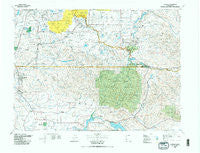
Centralia, Washington, USGS topographic map dated 1980.
Includes geographic coordinates (latitude and longitude). This topographic map is suitable for hiking, camping, and exploring, or framing it as a wall map.
Printed on-demand using high resolution imagery, on heavy weight and acid free paper, or alternatively on a variety of synthetic materials.
Topos available on paper, Waterproof, Poly, or Tyvek. Usually shipping rolled, unless combined with other folded maps in one order.
- Product Number: USGS-5410946
- Free digital map download (high-resolution, GeoPDF): Centralia, Washington (file size: 29 MB)
- Map Size: please refer to the dimensions of the GeoPDF map above
- Weight (paper map): ca. 55 grams
- Map Type: POD USGS Topographic Map
- Map Series: HTMC
- Map Verison: Historical
- Cell ID: 76788
- Scan ID: 239702
- Imprint Year: 1980
- Woodland Tint: Yes
- Aerial Photo Year: 1975
- Edit Year: 1980
- Datum: NAD27
- Map Projection: Universal Transverse Mercator
- Map published by United States Geological Survey
- Map Language: English
- Scanner Resolution: 600 dpi
- Map Cell Name: Centralia
- Grid size: 30 X 60 Minute
- Date on map: 1980
- Map Scale: 1:100000
- Geographical region: Washington, United States
Neighboring Maps:
All neighboring USGS topo maps are available for sale online at a variety of scales.
Spatial coverage:
Topo map Centralia, Washington, covers the geographical area associated the following places:
- Alpha - McIntosh - Newaukum - Forest - Mill Village Mobile Home Park - Belmore - Bremer - Ethel - Cinebar - Rainier - Bush - Alder - Morton - Maytown - Silver Creek - Riffe (historical) - Saint Urban - Eatonville - Harmony - Fords Prairie - Eatonville Junction - Tenino - Klaus - Skookumchuck - East Olympia - Ohop - Yelm - Chain Hill - Centralia - Blakeslee Junction - Royal Oak Mobile Home Park - National - Kopiah - Wabash - Western Junction - Voss Resort - Marys Corner - Chehalis - Evaline - Tono - La Grande - Leber - Kellys Korner - Elbe - Swofford - Jack Travis Estates Mobile Home Park - Country Green Estates Mobile Home Park - Oxley - Sunnydale - Four Corners - Surprise Valley - Plumb - Phillips - Kapowsin - Mock City - McKenna - South Union - Five Corners - Lacamas - Napavine - Reliance - Glenoma - Onalaska - Salkum - Park Junction - Mayfield - Vail - Ashford - Ajlune - Offutt Lake - New Reliance - Johnsons Corner - Carlson - North Yelm - Ohop Bob - Mineral - Jims Corner - Clay City - Electron - Bucoda - Country Lane Mobile Home Park - Mossyrock - McKenna Heights Mobile Home Park - Fir Tree - Nulls Crossing
- Map Area ID: AREA4746.5-123-122
- Northwest corner Lat/Long code: USGSNW47-123
- Northeast corner Lat/Long code: USGSNE47-122
- Southwest corner Lat/Long code: USGSSW46.5-123
- Southeast corner Lat/Long code: USGSSE46.5-122
- Northern map edge Latitude: 47
- Southern map edge Latitude: 46.5
- Western map edge Longitude: -123
- Eastern map edge Longitude: -122


