
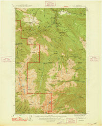
~ Tyler Peak WA topo map, 1:62500 scale, 15 X 15 Minute, Historical, 1948
Tyler Peak, Washington, USGS topographic map dated 1948.
Includes geographic coordinates (latitude and longitude). This topographic map is suitable for hiking, camping, and exploring, or framing it as a wall map.
Printed on-demand using high resolution imagery, on heavy weight and acid free paper, or alternatively on a variety of synthetic materials.
Topos available on paper, Waterproof, Poly, or Tyvek. Usually shipping rolled, unless combined with other folded maps in one order.
- Product Number: USGS-5410814
- Free digital map download (high-resolution, GeoPDF): Tyler Peak, Washington (file size: 10 MB)
- Map Size: please refer to the dimensions of the GeoPDF map above
- Weight (paper map): ca. 55 grams
- Map Type: POD USGS Topographic Map
- Map Series: HTMC
- Map Verison: Historical
- Cell ID: 63796
- Scan ID: 244402
- Woodland Tint: Yes
- Datum: NAD27
- Map Projection: Polyconic
- Map published by United States Geological Survey
- Map Language: English
- Scanner Resolution: 600 dpi
- Map Cell Name: Tyler Peak
- Grid size: 15 X 15 Minute
- Date on map: 1948
- Map Scale: 1:62500
- Geographical region: Washington, United States
Neighboring Maps:
All neighboring USGS topo maps are available for sale online at a variety of scales.
Spatial coverage:
Topo map Tyler Peak, Washington, covers the geographical area associated the following places:
- West Branch Home Creek - Buckhorn Mountain - Camp Windy - Mount Mystery - Dirty Face Ridge - Mount Fricaba - Dungeness Forks Campground - Maynard Burn Way (historical) - Sutherland Creek - Mount Zion - Dirty Face Trail (historical) - Slide Creek - Tubal Cain Mine Trail - Still Creek - Deception Basin - Mount Constance - Home Lake - Cat Creek - Constance Pass - Lower Twin Creek - Camp Jolley - Hal Foss Peak - Mount Townsend - Little Quilcene Trail (historical) - Mount Zion Lookout - Camp Handy - Jolley Creek - Mount Clark - Elwick Dam - Slab Camp Creek - Home Creek - Tyler Peak - Crag Creek - Last Water Camp (historical) - Skookum Creek - Sunnybrook Meadows - East Crossing Campground - Colonel Shelter (historical) - Camp Mystery - Maynard Peak - Milk Creek - Mount Townsend Lookout - Louella Guard Station (historical) - Gray Wolf - Silver Creek Shelter - Mueller Creek - Three O'Clock Ridge - Tunnel Creek Shelter - Boulder Shelter - Bon Jon Pass - Cougar Creek - Ned Hill Trail (historical) - Silver Lake - Harrison Lake - Divide Creek - Bear Mountain Trail (historical) - Grand Creek - Twomile Camp - Royal Basin - Slab Camp Guard Station (historical) - Bungalow Creek - Shelter Rock Camp - Baldy Trail (historical) - River Campground - Big Canyon Camp (historical) - Gold Creek - Wet Weather Creek - Little River Summit - Three Forks Shelter - Bear Mountain - Camp Ellis - Tenmile Shelter - Cameron Creek - Mineral Spring (historical) - Slide Camp - Gray Wolf Ridge - Deer Ridge - Quilcene Ranger District (historical) - Baldy - Marmot Pass - Sink Lake - Charlia Lakes - Tubal Cain Mine (historical) - Mount Walkinshaw - Gold Creek Shelter - Ghoul Creek - Mount Valerianos (not official) - Twin Creek - Heather Creek - Welch Peaks - Clink Trail (historical) - Buckhorn Wilderness - Little Mystery - Mount Deception - Gray Wolf Camp - Slide Creek - Hawk Creek - Eddy Creek - Quilcene Bay-Brinnon Division - Silver Creek
- Map Area ID: AREA4847.75-123.25-123
- Northwest corner Lat/Long code: USGSNW48-123.25
- Northeast corner Lat/Long code: USGSNE48-123
- Southwest corner Lat/Long code: USGSSW47.75-123.25
- Southeast corner Lat/Long code: USGSSE47.75-123
- Northern map edge Latitude: 48
- Southern map edge Latitude: 47.75
- Western map edge Longitude: -123.25
- Eastern map edge Longitude: -123


