
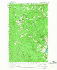
~ Tiffany Mountain WA topo map, 1:62500 scale, 15 X 15 Minute, Historical, 1956, updated 1966
Tiffany Mountain, Washington, USGS topographic map dated 1956.
Includes geographic coordinates (latitude and longitude). This topographic map is suitable for hiking, camping, and exploring, or framing it as a wall map.
Printed on-demand using high resolution imagery, on heavy weight and acid free paper, or alternatively on a variety of synthetic materials.
Topos available on paper, Waterproof, Poly, or Tyvek. Usually shipping rolled, unless combined with other folded maps in one order.
- Product Number: USGS-5410774
- Free digital map download (high-resolution, GeoPDF): Tiffany Mountain, Washington (file size: 9 MB)
- Map Size: please refer to the dimensions of the GeoPDF map above
- Weight (paper map): ca. 55 grams
- Map Type: POD USGS Topographic Map
- Map Series: HTMC
- Map Verison: Historical
- Cell ID: 63560
- Scan ID: 244288
- Imprint Year: 1966
- Woodland Tint: Yes
- Aerial Photo Year: 1953
- Field Check Year: 1956
- Datum: NAD27
- Map Projection: Polyconic
- Map published by United States Geological Survey
- Map Language: English
- Scanner Resolution: 600 dpi
- Map Cell Name: Tiffany Mountain
- Grid size: 15 X 15 Minute
- Date on map: 1956
- Map Scale: 1:62500
- Geographical region: Washington, United States
Neighboring Maps:
All neighboring USGS topo maps are available for sale online at a variety of scales.
Spatial coverage:
Topo map Tiffany Mountain, Washington, covers the geographical area associated the following places:
- Scheiner Creek - Brown Meadows Creek - Clark Creek - South Twentymile Meadows - Muckamuck Pass - Mutton Creek - Three Buttes - Ryan Cabin (historical) - Mount McCay - Roger Lake - Timothy Ridge - Cedar Creek - Ray Creek - Kerr Campground - Deer Ridge - Blue Buck Trail - West Fork Salmon Creek - Middle Mountain - Parachute Meadow - Cougar Mountain - McCay Trail - Rusty Creek - Alder Campground - Peak Creek - Peacock Meadows - Clark Ridge Trail - Coxit Mountain - Jim Creek - North Fork Coxit Creek - Spur Creek - Little Granite Creek - Tiffany Lake Trail - Lone Frank Creek - McCay Creek - Round Meadow - Angel Pass - Milk Creek - Whistler Pass - Pelican Pass - Peacock Mountain - Brown Meadows - Johnny Boy Mine - Conconully State Park - South Fork Trail - Buckhorn Creek - Salmon Meadows Campground - Sophys Meadows - Wilder Creek - Cottonwood Campground - Clark Peak - Conconully Reservoir - Smarty Creek - Freezeout Ridge - Tiffany Mountain - Lone Frank Pass - Brown Meadows - First Creek - North Twentymile Trail - Conconully Information Station - Muckamuck Mountain - Angel Pass Trail - Woodpile Ridge - Tiffany Lake - Oriole Campground - Pearrygin Trail - Reed Ranch - Kinchelo Creek - North Summit Trail - Timothy Creek - Freezeout Trail - Ray Trail (historical) - Bottle Spring - Isabel Creek - First Creek - Chute Creek - South Fork Salmon Creek - Blue Buck Ridge - Sunny Peak Mine - Funk Mountain Trail (historical) - Okanogan County Fire District 9 - Little Tiffany Lake - Conger Creek - Ray Cabin (historical) - Starvation Mountain - Woodpile Creek - Sarsapkin Creek Trail (historical) - Bernhardt Creek - Rock Mountain - Pretty Bird Trail (historical) - Baldy Pass - Little Granite Mountain - Mineral Hill - South Fork Coxit Creek - Whistler Basin - Tiffany Spring Campground - South Fork Twentymile Creek - Old Baldy - Muckamuck Hill - North Granite Creek - Bernhardt Mine
- Map Area ID: AREA48.7548.5-120-119.75
- Northwest corner Lat/Long code: USGSNW48.75-120
- Northeast corner Lat/Long code: USGSNE48.75-119.75
- Southwest corner Lat/Long code: USGSSW48.5-120
- Southeast corner Lat/Long code: USGSSE48.5-119.75
- Northern map edge Latitude: 48.75
- Southern map edge Latitude: 48.5
- Western map edge Longitude: -120
- Eastern map edge Longitude: -119.75


