
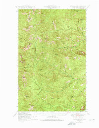
~ Sherman Peak WA topo map, 1:62500 scale, 15 X 15 Minute, Historical, 1948, updated 1976
Sherman Peak, Washington, USGS topographic map dated 1948.
Includes geographic coordinates (latitude and longitude). This topographic map is suitable for hiking, camping, and exploring, or framing it as a wall map.
Printed on-demand using high resolution imagery, on heavy weight and acid free paper, or alternatively on a variety of synthetic materials.
Topos available on paper, Waterproof, Poly, or Tyvek. Usually shipping rolled, unless combined with other folded maps in one order.
- Product Number: USGS-5410660
- Free digital map download (high-resolution, GeoPDF): Sherman Peak, Washington (file size: 12 MB)
- Map Size: please refer to the dimensions of the GeoPDF map above
- Weight (paper map): ca. 55 grams
- Map Type: POD USGS Topographic Map
- Map Series: HTMC
- Map Verison: Historical
- Cell ID: 62450
- Scan ID: 243692
- Imprint Year: 1976
- Woodland Tint: Yes
- Aerial Photo Year: 1944
- Field Check Year: 1948
- Datum: NAD27
- Map Projection: Polyconic
- Map published by United States Forest Service
- Map Language: English
- Scanner Resolution: 600 dpi
- Map Cell Name: Sherman Peak
- Grid size: 15 X 15 Minute
- Date on map: 1948
- Map Scale: 1:62500
- Geographical region: Washington, United States
Neighboring Maps:
All neighboring USGS topo maps are available for sale online at a variety of scales.
Spatial coverage:
Topo map Sherman Peak, Washington, covers the geographical area associated the following places:
- Elbow Creek - Hoodoo Creek - King Creek - Cedar Ridge - Emerald Lake - Sherman Creek Falls - Hoodoo Canyon - Lane Creek - Graves Creek - Columbia Mountain - Paradise Peak - High Bridge Creek - Sherman Pass Campground - South Fork Sherman Creek - Midnight Mountain - U S Mountain - South Fork Barnaby Creek - Lilly Lake - White Mountain - Jackknife Mountain Lookout - Fritz Creek - Albian Hill - South Huckleberry Mountain - C C Mountain - Scar Mountain - Coyote Mountain - Snowshoe Camp - Betty Creek - Nueske Creek - Barnaby Buttes - White Mountain Lookout - Camp Creek - Wash Creek - South Huckleberry Mountain Lookout - Merkel Canyon - Mack Mountain - Growden Dam (historical) - Copper Butte - King Mountain - Hart Creek - Growden Guard Station (historical) - Wapaloosie Mountain - Snowshoe Creek - Pass Creek - Bridge Creek - Snow Peak - Sherman Peak - Milk Creek - Lambert Mountain - Graves Mountain - Jackknife Mountain - East Ferry Division - Twin Sisters - Stickpin Hill - Bailey Creek - M J B Creek - Scalawag Ridge - Jungle Hill - North Fork Sherman Creek - Sherman Lake (historical) - Columbia Mountain Lookout - Sherman Pass - Alligator Ridge - McGahee Creek
- Map Area ID: AREA48.7548.5-118.5-118.25
- Northwest corner Lat/Long code: USGSNW48.75-118.5
- Northeast corner Lat/Long code: USGSNE48.75-118.25
- Southwest corner Lat/Long code: USGSSW48.5-118.5
- Southeast corner Lat/Long code: USGSSE48.5-118.25
- Northern map edge Latitude: 48.75
- Southern map edge Latitude: 48.5
- Western map edge Longitude: -118.5
- Eastern map edge Longitude: -118.25


