
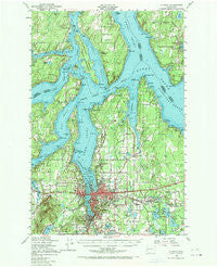
~ Olympia WA topo map, 1:62500 scale, 15 X 15 Minute, Historical, 1949, updated 1970
Olympia, Washington, USGS topographic map dated 1949.
Includes geographic coordinates (latitude and longitude). This topographic map is suitable for hiking, camping, and exploring, or framing it as a wall map.
Printed on-demand using high resolution imagery, on heavy weight and acid free paper, or alternatively on a variety of synthetic materials.
Topos available on paper, Waterproof, Poly, or Tyvek. Usually shipping rolled, unless combined with other folded maps in one order.
- Product Number: USGS-5410394
- Free digital map download (high-resolution, GeoPDF): Olympia, Washington (file size: 10 MB)
- Map Size: please refer to the dimensions of the GeoPDF map above
- Weight (paper map): ca. 55 grams
- Map Type: POD USGS Topographic Map
- Map Series: HTMC
- Map Verison: Historical
- Cell ID: 60522
- Scan ID: 242943
- Imprint Year: 1970
- Woodland Tint: Yes
- Aerial Photo Year: 1947
- Field Check Year: 1949
- Survey Year: 1934
- Datum: NAD27
- Map Projection: Polyconic
- Map published by United States Army Corps of Engineers
- Map Language: English
- Scanner Resolution: 600 dpi
- Map Cell Name: Olympia
- Grid size: 15 X 15 Minute
- Date on map: 1949
- Map Scale: 1:62500
- Geographical region: Washington, United States
Neighboring Maps:
All neighboring USGS topo maps are available for sale online at a variety of scales.
Spatial coverage:
Topo map Olympia, Washington, covers the geographical area associated the following places:
- Edgewater Beach - Tumwater - Marshville (historical) - Tanglewilde - Union Mill - Longbranch - Gravelly Beach - Sunrise Beach - Olympia - Mushroom Corner - North Olympia - Rignall - Carlyon Beach - Lamberts Corner - South Bay - Ballow - Sunset Beach - Graham Point - Thompson Place - Puget - Lacey - Arcadia - Boston Harbor
- Map Area ID: AREA47.2547-123-122.75
- Northwest corner Lat/Long code: USGSNW47.25-123
- Northeast corner Lat/Long code: USGSNE47.25-122.75
- Southwest corner Lat/Long code: USGSSW47-123
- Southeast corner Lat/Long code: USGSSE47-122.75
- Northern map edge Latitude: 47.25
- Southern map edge Latitude: 47
- Western map edge Longitude: -123
- Eastern map edge Longitude: -122.75


