
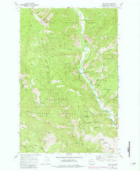
~ Tyee Mtn WA topo map, 1:24000 scale, 7.5 X 7.5 Minute, Historical, 1968, updated 1981
Tyee Mtn , Washington, USGS topographic map dated 1968.
Includes geographic coordinates (latitude and longitude). This topographic map is suitable for hiking, camping, and exploring, or framing it as a wall map.
Printed on-demand using high resolution imagery, on heavy weight and acid free paper, or alternatively on a variety of synthetic materials.
Topos available on paper, Waterproof, Poly, or Tyvek. Usually shipping rolled, unless combined with other folded maps in one order.
- Product Number: USGS-5408866
- Free digital map download (high-resolution, GeoPDF): Tyee Mtn , Washington (file size: 15 MB)
- Map Size: please refer to the dimensions of the GeoPDF map above
- Weight (paper map): ca. 55 grams
- Map Type: POD USGS Topographic Map
- Map Series: HTMC
- Map Verison: Historical
- Cell ID: 46204
- Scan ID: 244396
- Imprint Year: 1981
- Woodland Tint: Yes
- Photo Revision Year: 1981
- Aerial Photo Year: 1978
- Edit Year: 1981
- Field Check Year: 1968
- Datum: NAD27
- Map Projection: Polyconic
- Map published by United States Geological Survey
- Map Language: English
- Scanner Resolution: 600 dpi
- Map Cell Name: Tyee Mountain
- Grid size: 7.5 X 7.5 Minute
- Date on map: 1968
- Map Scale: 1:24000
- Geographical region: Washington, United States
Neighboring Maps:
All neighboring USGS topo maps are available for sale online at a variety of scales.
Spatial coverage:
Topo map Tyee Mtn , Washington, covers the geographical area associated the following places:
- Entiat Division - Young Creek - Gray Canyon - Stormy Creek - Entiat Valley Ski Area - McKenzie Saddle - Pine Flat Campground - Tyee Ridge Spring Number 7 - Potato Creek - North Fork Potato Creek - Decker Canyon - Roundy Creek - Young Creek Shelter - Shamel Creek - Hornet Ridge - Tyee Ridge Spring Number 2 - Tyee Mountain Lookout - Camp Nine - Dill Creek - Tyee Ridge Spring Number 6 - Tyee Ridge Spring Number 1 - Hornet Creek - Tyee Creek - South Fork Grays Canyon - McKenzie Canyon - Gold Ridge - Tyee Mountain - North Fork Gray Canyon - Tyee Ridge Spring Number 8 - Tyee Ridge - Windy Creek - Tyee Ridge Spring Number 3
- Map Area ID: AREA47.87547.75-120.5-120.375
- Northwest corner Lat/Long code: USGSNW47.875-120.5
- Northeast corner Lat/Long code: USGSNE47.875-120.375
- Southwest corner Lat/Long code: USGSSW47.75-120.5
- Southeast corner Lat/Long code: USGSSE47.75-120.375
- Northern map edge Latitude: 47.875
- Southern map edge Latitude: 47.75
- Western map edge Longitude: -120.5
- Eastern map edge Longitude: -120.375


