
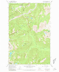
~ Stevens Pass WA topo map, 1:24000 scale, 7.5 X 7.5 Minute, Historical, 1965, updated 1981
Stevens Pass, Washington, USGS topographic map dated 1965.
Includes geographic coordinates (latitude and longitude). This topographic map is suitable for hiking, camping, and exploring, or framing it as a wall map.
Printed on-demand using high resolution imagery, on heavy weight and acid free paper, or alternatively on a variety of synthetic materials.
Topos available on paper, Waterproof, Poly, or Tyvek. Usually shipping rolled, unless combined with other folded maps in one order.
- Product Number: USGS-5408400
- Free digital map download (high-resolution, GeoPDF): Stevens Pass, Washington (file size: 15 MB)
- Map Size: please refer to the dimensions of the GeoPDF map above
- Weight (paper map): ca. 55 grams
- Map Type: POD USGS Topographic Map
- Map Series: HTMC
- Map Verison: Historical
- Cell ID: 43156
- Scan ID: 244048
- Imprint Year: 1981
- Woodland Tint: Yes
- Photo Inspection Year: 1978
- Aerial Photo Year: 1958
- Field Check Year: 1965
- Datum: NAD27
- Map Projection: Polyconic
- Map published by United States Geological Survey
- Map Language: English
- Scanner Resolution: 600 dpi
- Map Cell Name: Stevens Pass
- Grid size: 7.5 X 7.5 Minute
- Date on map: 1965
- Map Scale: 1:24000
- Geographical region: Washington, United States
Neighboring Maps:
All neighboring USGS topo maps are available for sale online at a variety of scales.
Spatial coverage:
Topo map Stevens Pass, Washington, covers the geographical area associated the following places:
- New Cascade Tunnel - Stevens Pass Recreation Area - The Barrier - Stevens Pass - Lake Cuitin - Trap Lake - Big Chief Mountain - Trapper Creek - Pacific Crest Trailhead - Mule Creek - Leland Creek - Prospect Creek - Grass Lake - Stevens Pass Guard Station - Lake Wolverine - Bulls Tooth - Lake Lorraine Point - Chain Creek - Doelle Lakes - Cowboy Mountain - Basin Creek - Steven Pass Org Site - Cascade Tunnel - Grace Lakes - Square Lake - Chain Lakes - Josephine Lake - Swallow Lakes - Cuitin Creek - Lake Lorraine - Square Lake Dam - Bark Cabin - Mig Lake - French Ridge - Swimming Deer Lake - Doughgod Creek - Summit Lake - Lake Susan Jane - Tye - Thunder Mountain - Milk Lake - Jim Hill Mountain - Hope Lake - Mac Peak
- Map Area ID: AREA47.7547.625-121.125-121
- Northwest corner Lat/Long code: USGSNW47.75-121.125
- Northeast corner Lat/Long code: USGSNE47.75-121
- Southwest corner Lat/Long code: USGSSW47.625-121.125
- Southeast corner Lat/Long code: USGSSE47.625-121
- Northern map edge Latitude: 47.75
- Southern map edge Latitude: 47.625
- Western map edge Longitude: -121.125
- Eastern map edge Longitude: -121


