
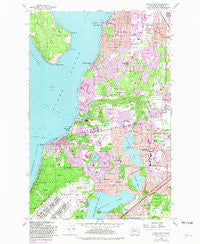
~ Steilacoom WA topo map, 1:24000 scale, 7.5 X 7.5 Minute, Historical, 1959, updated 1981
Steilacoom, Washington, USGS topographic map dated 1959.
Includes geographic coordinates (latitude and longitude). This topographic map is suitable for hiking, camping, and exploring, or framing it as a wall map.
Printed on-demand using high resolution imagery, on heavy weight and acid free paper, or alternatively on a variety of synthetic materials.
Topos available on paper, Waterproof, Poly, or Tyvek. Usually shipping rolled, unless combined with other folded maps in one order.
- Product Number: USGS-5408366
- Free digital map download (high-resolution, GeoPDF): Steilacoom, Washington (file size: 18 MB)
- Map Size: please refer to the dimensions of the GeoPDF map above
- Weight (paper map): ca. 55 grams
- Map Type: POD USGS Topographic Map
- Map Series: HTMC
- Map Verison: Historical
- Cell ID: 43073
- Scan ID: 244030
- Imprint Year: 1981
- Woodland Tint: Yes
- Photo Revision Year: 1981
- Aerial Photo Year: 1978
- Edit Year: 1981
- Datum: NAD27
- Map Projection: Polyconic
- Map published by United States Geological Survey
- Map Language: English
- Scanner Resolution: 600 dpi
- Map Cell Name: Steilacoom
- Grid size: 7.5 X 7.5 Minute
- Date on map: 1959
- Map Scale: 1:24000
- Geographical region: Washington, United States
Neighboring Maps:
All neighboring USGS topo maps are available for sale online at a variety of scales.
Spatial coverage:
Topo map Steilacoom, Washington, covers the geographical area associated the following places:
- Rose Garden Mobile Home Park - Pioneer - Acorn Meadows Mobile Home Park - Lake City - Clinton Park - Titlow - Eastward - Lakewood - Custer - Fir Acres Mobile Home Park - Interlaken - Northwest Mobile Home Park - Ketron - Bobs Mobile Home Park - University Place - Steilacoom - Ponders Corner - Hope - Sunrise Terrace Mobile Home Court - Peach Acres - Fircrest - Clover Park - Sunset Beach - Sunrise Manor Mobile Home Park
- Map Area ID: AREA47.2547.125-122.625-122.5
- Northwest corner Lat/Long code: USGSNW47.25-122.625
- Northeast corner Lat/Long code: USGSNE47.25-122.5
- Southwest corner Lat/Long code: USGSSW47.125-122.625
- Southeast corner Lat/Long code: USGSSE47.125-122.5
- Northern map edge Latitude: 47.25
- Southern map edge Latitude: 47.125
- Western map edge Longitude: -122.625
- Eastern map edge Longitude: -122.5


