
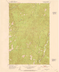
~ Gillette Mtn WA topo map, 1:24000 scale, 7.5 X 7.5 Minute, Historical, 1952, updated 1953
Gillette Mtn, Washington, USGS topographic map dated 1952.
Includes geographic coordinates (latitude and longitude). This topographic map is suitable for hiking, camping, and exploring, or framing it as a wall map.
Printed on-demand using high resolution imagery, on heavy weight and acid free paper, or alternatively on a variety of synthetic materials.
Topos available on paper, Waterproof, Poly, or Tyvek. Usually shipping rolled, unless combined with other folded maps in one order.
- Product Number: USGS-5404430
- Free digital map download (high-resolution, GeoPDF): Gillette Mtn, Washington (file size: 12 MB)
- Map Size: please refer to the dimensions of the GeoPDF map above
- Weight (paper map): ca. 55 grams
- Map Type: POD USGS Topographic Map
- Map Series: HTMC
- Map Verison: Historical
- Cell ID: 70176
- Scan ID: 241277
- Imprint Year: 1953
- Woodland Tint: Yes
- Aerial Photo Year: 1946
- Field Check Year: 1952
- Datum: NAD27
- Map Projection: Polyconic
- Map published by United States Geological Survey
- Map Language: English
- Scanner Resolution: 600 dpi
- Map Cell Name: Gillette Mountain
- Grid size: 7.5 X 7.5 Minute
- Date on map: 1952
- Map Scale: 1:24000
- Geographical region: Washington, United States
Neighboring Maps:
All neighboring USGS topo maps are available for sale online at a variety of scales.
Spatial coverage:
Topo map Gillette Mtn, Washington, covers the geographical area associated the following places:
- Uncle Sam Mountain - Davis Canyon - Jumpoff Joe Creek - Neglected Mine - Gillette Mountain - Marble Creek - Tenderfoot Mine - Indian Creek - Chloride Queen Mine - Echo Mine - Reed Ranch - Binger Canyon - Big Chief Mine - Old Douglas - Green Mountain - Churchill Ridge - Galena Farm Mine - Staghorn Mountain - Shoemaker Mine - Strauss Creek - Lucky Boy Mine - Marble Quarry - Howard Meadows - Little Roundtop - Jumpoff Joe Bluff - Baldy - Onion Mountain - Mount Rogers - Comstock - Galena Knob Mine
- Map Area ID: AREA48.7548.625-117.875-117.75
- Northwest corner Lat/Long code: USGSNW48.75-117.875
- Northeast corner Lat/Long code: USGSNE48.75-117.75
- Southwest corner Lat/Long code: USGSSW48.625-117.875
- Southeast corner Lat/Long code: USGSSE48.625-117.75
- Northern map edge Latitude: 48.75
- Southern map edge Latitude: 48.625
- Western map edge Longitude: -117.875
- Eastern map edge Longitude: -117.75


