
~ Darland Mtn WA topo map, 1:24000 scale, 7.5 X 7.5 Minute, Historical, 1967, updated 1987
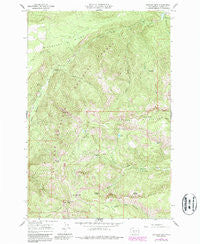
Darland Mtn, Washington, USGS topographic map dated 1967.
Includes geographic coordinates (latitude and longitude). This topographic map is suitable for hiking, camping, and exploring, or framing it as a wall map.
Printed on-demand using high resolution imagery, on heavy weight and acid free paper, or alternatively on a variety of synthetic materials.
Topos available on paper, Waterproof, Poly, or Tyvek. Usually shipping rolled, unless combined with other folded maps in one order.
- Product Number: USGS-5403692
- Free digital map download (high-resolution, GeoPDF): Darland Mtn, Washington (file size: 16 MB)
- Map Size: please refer to the dimensions of the GeoPDF map above
- Weight (paper map): ca. 55 grams
- Map Type: POD USGS Topographic Map
- Map Series: HTMC
- Map Verison: Historical
- Cell ID: 11371
- Scan ID: 240778
- Imprint Year: 1987
- Woodland Tint: Yes
- Photo Revision Year: 1987
- Aerial Photo Year: 1983
- Edit Year: 1987
- Field Check Year: 1967
- Datum: NAD27
- Map Projection: Polyconic
- Map published by United States Geological Survey
- Map Language: English
- Scanner Resolution: 600 dpi
- Map Cell Name: Darland Mountain
- Grid size: 7.5 X 7.5 Minute
- Date on map: 1967
- Map Scale: 1:24000
- Geographical region: Washington, United States
Neighboring Maps:
All neighboring USGS topo maps are available for sale online at a variety of scales.
Spatial coverage:
Topo map Darland Mtn, Washington, covers the geographical area associated the following places:
- Dead Hole - East Fork Short and Dirty Creek - Withrow Spring - Clover Flats - Blue Slide Lookout Tower - Camp Creek - Grey Creek - Buckhorn Meadows - Shellneck Creek - Fish Creek - Spruce Creek - Bakeoven Flats - Blue Slide - Cedar Creek - Strobach Springs - South Fork Campground - Spruce Spring - Grey Creek Campground - Blue Lake - Little Lake - Greens Pocket - Jayhawk Flats - Spencer Creek - Minnie Meadows - Whites Pocket - Cougar Flats - Short and Dirty Creek - Short and Dirty Ridge - Blue Slide - Darland Mountain - Narrowneck Gap - Corral Creek - Green Lake - South Fork Tieton River
- Map Area ID: AREA46.62546.5-121.25-121.125
- Northwest corner Lat/Long code: USGSNW46.625-121.25
- Northeast corner Lat/Long code: USGSNE46.625-121.125
- Southwest corner Lat/Long code: USGSSW46.5-121.25
- Southeast corner Lat/Long code: USGSSE46.5-121.125
- Northern map edge Latitude: 46.625
- Southern map edge Latitude: 46.5
- Western map edge Longitude: -121.25
- Eastern map edge Longitude: -121.125


