
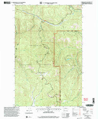
~ Corral Butte WA topo map, 1:24000 scale, 7.5 X 7.5 Minute, Historical, 2001, updated 2004
Corral Butte, Washington, USGS topographic map dated 2001.
Includes geographic coordinates (latitude and longitude). This topographic map is suitable for hiking, camping, and exploring, or framing it as a wall map.
Printed on-demand using high resolution imagery, on heavy weight and acid free paper, or alternatively on a variety of synthetic materials.
Topos available on paper, Waterproof, Poly, or Tyvek. Usually shipping rolled, unless combined with other folded maps in one order.
- Product Number: USGS-5403562
- Free digital map download (high-resolution, GeoPDF): Corral Butte, Washington (file size: 16 MB)
- Map Size: please refer to the dimensions of the GeoPDF map above
- Weight (paper map): ca. 55 grams
- Map Type: POD USGS Topographic Map
- Map Series: HTMC
- Map Verison: Historical
- Cell ID: 10186
- Scan ID: 240687
- Imprint Year: 2004
- Woodland Tint: Yes
- Aerial Photo Year: 1998
- Edit Year: 2001
- Datum: NAD27
- Map Projection: Lambert Conformal Conic
- Map published by United States Forest Service
- Map Language: English
- Scanner Resolution: 600 dpi
- Map Cell Name: Corral Butte
- Grid size: 7.5 X 7.5 Minute
- Date on map: 2001
- Map Scale: 1:24000
- Geographical region: Washington, United States
Neighboring Maps:
All neighboring USGS topo maps are available for sale online at a variety of scales.
Spatial coverage:
Topo map Corral Butte, Washington, covers the geographical area associated the following places:
- Twentymile Camp - Wildhorse Camp - West Fork Twentymile Creek - Crosby Creek - Inlow Camp - Thirtymile Meadows - Chow Creek - Long Swamp Trailhead - Thunder Mountain - North Twentymile Peak Trail - Thirtymile Trail - Corral Butte - Dill Creek - Hilltop Creek - Middle Fork Twentymile Creek - Skull Camp - Four Point Corral - North Twentymile Meadows - Irenes Camp - Wildhorse Creek - Crosby Camp - Long Swamp Trail - Hunter Meadows - Lightning Camp - Lost Spoon Camp - Long Swamp Campground - Queer Creek - Long Swamp - Thunder Camp
- Map Area ID: AREA48.87548.75-120-119.875
- Northwest corner Lat/Long code: USGSNW48.875-120
- Northeast corner Lat/Long code: USGSNE48.875-119.875
- Southwest corner Lat/Long code: USGSSW48.75-120
- Southeast corner Lat/Long code: USGSSE48.75-119.875
- Northern map edge Latitude: 48.875
- Southern map edge Latitude: 48.75
- Western map edge Longitude: -120
- Eastern map edge Longitude: -119.875


