
~ Boundary Dam WA topo map, 1:24000 scale, 7.5 X 7.5 Minute, Historical, 1992, updated 1997
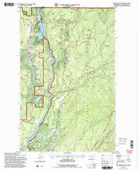
Boundary Dam, Washington, USGS topographic map dated 1992.
Includes geographic coordinates (latitude and longitude). This topographic map is suitable for hiking, camping, and exploring, or framing it as a wall map.
Printed on-demand using high resolution imagery, on heavy weight and acid free paper, or alternatively on a variety of synthetic materials.
Topos available on paper, Waterproof, Poly, or Tyvek. Usually shipping rolled, unless combined with other folded maps in one order.
- Product Number: USGS-5402902
- Free digital map download (high-resolution, GeoPDF): Boundary Dam, Washington (file size: 17 MB)
- Map Size: please refer to the dimensions of the GeoPDF map above
- Weight (paper map): ca. 55 grams
- Map Type: POD USGS Topographic Map
- Map Series: HTMC
- Map Verison: Historical
- Cell ID: 4996
- Scan ID: 240169
- Imprint Year: 1997
- Woodland Tint: Yes
- Aerial Photo Year: 1991
- Field Check Year: 1992
- Datum: NAD27
- Map Projection: Lambert Conformal Conic
- Map published by United States Geological Survey
- Map published by United States Forest Service
- Map Language: English
- Scanner Resolution: 600 dpi
- Map Cell Name: Boundary Dam
- Grid size: 7.5 X 7.5 Minute
- Date on map: 1992
- Map Scale: 1:24000
- Geographical region: Washington, United States
Neighboring Maps:
All neighboring USGS topo maps are available for sale online at a variety of scales.
Spatial coverage:
Topo map Boundary Dam, Washington, covers the geographical area associated the following places:
- Beaver Creek - Crowell Mountain - Lime Creek - Pewee Falls - Crescent Lake - Lead King Hills - Vista House - Slate Creek - Uncas Gulch - Harvey Grave - Pend Oreille Mine Taillings Pond - Pend Oreille Mine Tailings Pond Dam - Eldorado Creek - Everett Creek - Deadmans Eddy - Crescent Lake Campground - Divide Peak - Z Canyon - Boundary Substation Heliport - Metalline Falls Port of Entry - Crater Lake - Boundary Dam - Blue Bird Ridge - Grandview Mine - Flume Creek - Threemile Creek - Josephine Mine - Crawford State Park - Dolomite Mountain - Forest Mountain - Horsefly Hill - Boundary Ridge - Pewee Creek - Lower Lead King Lake - Fence Creek - Pend Oreille Mine - Slumber Creek - Riverside Mine - Confusion Ridge - Contact Mountain - Grandview Pit - Boundary Lake - Ledbetter Lake - Morning Mine - Slumber Peak - Upper Lead King Lake - Whiskey Gulch - Timber Hill - Lucky Strike Mine
- Map Area ID: AREA4948.875-117.375-117.25
- Northwest corner Lat/Long code: USGSNW49-117.375
- Northeast corner Lat/Long code: USGSNE49-117.25
- Southwest corner Lat/Long code: USGSSW48.875-117.375
- Southeast corner Lat/Long code: USGSSE48.875-117.25
- Northern map edge Latitude: 49
- Southern map edge Latitude: 48.875
- Western map edge Longitude: -117.375
- Eastern map edge Longitude: -117.25


