
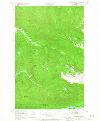
~ Bogachiel Peak WA topo map, 1:24000 scale, 7.5 X 7.5 Minute, Historical, 1950, updated 1965
Bogachiel Peak, Washington, USGS topographic map dated 1950.
Includes geographic coordinates (latitude and longitude). This topographic map is suitable for hiking, camping, and exploring, or framing it as a wall map.
Printed on-demand using high resolution imagery, on heavy weight and acid free paper, or alternatively on a variety of synthetic materials.
Topos available on paper, Waterproof, Poly, or Tyvek. Usually shipping rolled, unless combined with other folded maps in one order.
- Product Number: USGS-5402870
- Free digital map download (high-resolution, GeoPDF): Bogachiel Peak, Washington (file size: 15 MB)
- Map Size: please refer to the dimensions of the GeoPDF map above
- Weight (paper map): ca. 55 grams
- Map Type: POD USGS Topographic Map
- Map Series: HTMC
- Map Verison: Historical
- Cell ID: 4675
- Scan ID: 240148
- Imprint Year: 1965
- Woodland Tint: Yes
- Aerial Photo Year: 1943
- Field Check Year: 1950
- Datum: NAD27
- Map Projection: Polyconic
- Map published by United States Geological Survey
- Map published by United States Army Corps of Engineers
- Map published by United States Army
- Map Language: English
- Scanner Resolution: 600 dpi
- Map Cell Name: Bogachiel Peak
- Grid size: 7.5 X 7.5 Minute
- Date on map: 1950
- Map Scale: 1:24000
- Geographical region: Washington, United States
Neighboring Maps:
All neighboring USGS topo maps are available for sale online at a variety of scales.
Spatial coverage:
Topo map Bogachiel Peak, Washington, covers the geographical area associated the following places:
- Sol Duc Hot Springs - Solduc Post Office (historical) - Olympus Ranger Station - Hidden Lake - Hoh Creek - Lunch Lake - Hoh Lake - Boulder Peak - Boulder Lake Shelter - Olympus Guard Station - Sol Duc Falls - Canyon Creek Hoh Trail - Deer Lake - Deer Lake Cutoff - Bogachiel Lake - Soleduck Ranger Station - Canyon Creek - Round Lake - Seven Lakes Basin - Lovers Lane - Seven Lakes Ranger Station - Canyon Creek Shelter - Upper Hoh River Trail - Y Lake - Seven Lakes Creek - Deer Lake Trail - Mink Lake Trail - Long Lake - No Name Lake - Sol Duc Lake - Bogachiel Peak - Soleduck Campground - Bogachiel Park - Deer Lake Shelter - Morgenroth Lake - Green Peak - Mink Lake - Clear Lake - Soleduck Trail - Low Divide
- Map Area ID: AREA4847.875-123.875-123.75
- Northwest corner Lat/Long code: USGSNW48-123.875
- Northeast corner Lat/Long code: USGSNE48-123.75
- Southwest corner Lat/Long code: USGSSW47.875-123.875
- Southeast corner Lat/Long code: USGSSE47.875-123.75
- Northern map edge Latitude: 48
- Southern map edge Latitude: 47.875
- Western map edge Longitude: -123.875
- Eastern map edge Longitude: -123.75


