
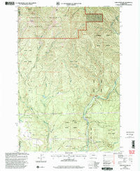
~ Bobs Mountain WA topo map, 1:24000 scale, 7.5 X 7.5 Minute, Historical, 2000, updated 2003
Bobs Mountain, Washington, USGS topographic map dated 2000.
Includes geographic coordinates (latitude and longitude). This topographic map is suitable for hiking, camping, and exploring, or framing it as a wall map.
Printed on-demand using high resolution imagery, on heavy weight and acid free paper, or alternatively on a variety of synthetic materials.
Topos available on paper, Waterproof, Poly, or Tyvek. Usually shipping rolled, unless combined with other folded maps in one order.
- Product Number: USGS-5402854
- Free digital map download (high-resolution, GeoPDF): Bobs Mountain, Washington (file size: 16 MB)
- Map Size: please refer to the dimensions of the GeoPDF map above
- Weight (paper map): ca. 55 grams
- Map Type: POD USGS Topographic Map
- Map Series: HTMC
- Map Verison: Historical
- Cell ID: 4648
- Scan ID: 240136
- Imprint Year: 2003
- Woodland Tint: Yes
- Aerial Photo Year: 1996
- Edit Year: 2000
- Datum: NAD27
- Map Projection: Lambert Conformal Conic
- Map published by United States Geological Survey
- Map published by United States Forest Service
- Map Language: English
- Scanner Resolution: 600 dpi
- Map Cell Name: Bobs Mountain
- Grid size: 7.5 X 7.5 Minute
- Date on map: 2000
- Map Scale: 1:24000
- Geographical region: Washington, United States
Neighboring Maps:
All neighboring USGS topo maps are available for sale online at a variety of scales.
Spatial coverage:
Topo map Bobs Mountain, Washington, covers the geographical area associated the following places:
- Silver Star Mountain Lookout - Dougan Creek Campground - Hagen Creek - Camp Kwoneesum Dam - Bobs Mountain - Prospector Creek - Caldwell Dam - Bluff Mountain - Last Chance Mine - Boyles Creek - Silver Star Mountain - Little Baldy - Bear Prairie - Washougal Ranger Station - Texas Creek - Camp Melacoma - Washougal Ponds - Washougal State Salmon Hatchery - Silver Creek - Silver Star Indian Pits - East County Fire and Rescue Station 96 - Dougan Creek Picnic Area - Sturgeon Rock - Dougan Falls - Jackson Creek - Bluebird Creek - Wildboy Creek - Pohls Hill - Hard Scramble Creek - Sky River Ranch Airport - Dougan Creek - Washougal Radio Fan Marker Beacon - Skamania Mine - McCloskey Creek
- Map Area ID: AREA45.7545.625-122.25-122.125
- Northwest corner Lat/Long code: USGSNW45.75-122.25
- Northeast corner Lat/Long code: USGSNE45.75-122.125
- Southwest corner Lat/Long code: USGSSW45.625-122.25
- Southeast corner Lat/Long code: USGSSE45.625-122.125
- Northern map edge Latitude: 45.75
- Southern map edge Latitude: 45.625
- Western map edge Longitude: -122.25
- Eastern map edge Longitude: -122.125


