
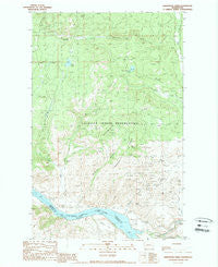
~ Armstrong Creek WA topo map, 1:24000 scale, 7.5 X 7.5 Minute, Historical, 1989, updated 1989
Armstrong Creek, Washington, USGS topographic map dated 1989.
Includes geographic coordinates (latitude and longitude). This topographic map is suitable for hiking, camping, and exploring, or framing it as a wall map.
Printed on-demand using high resolution imagery, on heavy weight and acid free paper, or alternatively on a variety of synthetic materials.
Topos available on paper, Waterproof, Poly, or Tyvek. Usually shipping rolled, unless combined with other folded maps in one order.
- Product Number: USGS-5402478
- Free digital map download (high-resolution, GeoPDF): Armstrong Creek, Washington (file size: 13 MB)
- Map Size: please refer to the dimensions of the GeoPDF map above
- Weight (paper map): ca. 55 grams
- Map Type: POD USGS Topographic Map
- Map Series: HTMC
- Map Verison: Historical
- Cell ID: 1485
- Scan ID: 239861
- Imprint Year: 1989
- Woodland Tint: Yes
- Visual Version Number: 1
- Aerial Photo Year: 1983
- Edit Year: 1989
- Field Check Year: 1986
- Datum: NAD27
- Map Projection: Lambert Conformal Conic
- Provisional map: Yes
- Map published by United States Geological Survey
- Map Language: English
- Scanner Resolution: 600 dpi
- Map Cell Name: Armstrong Creek
- Grid size: 7.5 X 7.5 Minute
- Date on map: 1989
- Map Scale: 1:24000
- Geographical region: Washington, United States
Neighboring Maps:
All neighboring USGS topo maps are available for sale online at a variety of scales.
Spatial coverage:
Topo map Armstrong Creek, Washington, covers the geographical area associated the following places:
- Panama Mine - Nespelem Bar - Squaw Mountain - Nespelem Community Census Designated Place - Hobo Hill - Little Nespelem River - Great Western Lake - Sailor Boy Mine - Condon Spring - Spray Falls - Anchor Mine (historical) - Coyote Creek - Lost Creek - Nespelem Con Mine (historical) - Panama Canyon - Bissell Flat - Little Johnny Mine - Multnomah Falls - Nespelem River - Mount Iams - Hilo Hill - Mineral Ridge - Grant Lake - Armstrong Creek - Hudnut Canyon - Apache Mine - Armstrong Meadow
- Map Area ID: AREA48.2548.125-119.125-119
- Northwest corner Lat/Long code: USGSNW48.25-119.125
- Northeast corner Lat/Long code: USGSNE48.25-119
- Southwest corner Lat/Long code: USGSSW48.125-119.125
- Southeast corner Lat/Long code: USGSSE48.125-119
- Northern map edge Latitude: 48.25
- Southern map edge Latitude: 48.125
- Western map edge Longitude: -119.125
- Eastern map edge Longitude: -119


