
~ Piedmont WV topo map, 1:125000 scale, 30 X 30 Minute, Historical, 1895, updated 1912
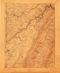
Piedmont, West Virginia, USGS topographic map dated 1895.
Includes geographic coordinates (latitude and longitude). This topographic map is suitable for hiking, camping, and exploring, or framing it as a wall map.
Printed on-demand using high resolution imagery, on heavy weight and acid free paper, or alternatively on a variety of synthetic materials.
Topos available on paper, Waterproof, Poly, or Tyvek. Usually shipping rolled, unless combined with other folded maps in one order.
- Product Number: USGS-5368696
- Free digital map download (high-resolution, GeoPDF): Piedmont, West Virginia (file size: 9 MB)
- Map Size: please refer to the dimensions of the GeoPDF map above
- Weight (paper map): ca. 55 grams
- Map Type: POD USGS Topographic Map
- Map Series: HTMC
- Map Verison: Historical
- Cell ID: 66226
- Scan ID: 257749
- Imprint Year: 1912
- Survey Year: 1894
- Datum: Unstated
- Map Projection: Unstated
- Map published by United States Geological Survey
- Map Language: English
- Scanner Resolution: 600 dpi
- Map Cell Name: Oakland
- Grid size: 30 X 30 Minute
- Date on map: 1895
- Map Scale: 1:125000
- Geographical region: West Virginia, United States
Neighboring Maps:
All neighboring USGS topo maps are available for sale online at a variety of scales.
Spatial coverage:
Topo map Piedmont, West Virginia, covers the geographical area associated the following places:
- Bismarck - Wilson - Dobbin - Fairfax - Rig - Fisher - Martin - Hartmansville - Windom (historical) - Mount Pisgah - Steyer - Lahmansville - East Vindex - William - Wallman - Wilson - West Virginia Central Junction - Mount Storm - Swanton - Gatzmer - Falls - Schell - Green Glade - Canaan Heights - Harrison - Chaffee - Forman - West Vindex - Nethkin - Strecker - Standard - Bloomington - Wabash (historical) - Antioch - Turner Douglass - Crosstown - Oak Hill - Walnut Bottom - Oakland - Shallmar - Sunnyside - Kempton Junction - Gleason (historical) - Skipnish (historical) - Redhouse - Scherr - Red Creek - Loch Lynn Heights - Medley - Thomas - Oakmont - New Creek - Fricks Crossing - Bayard - Kline Gap - Buena (historical) - Williamsport - Kessel - Hampshire - Mountain Lake Park - Kearney - Davis - Kitzmiller - Blaine - Jordan Run - Franklin - Barnum - Arthur - Berrett (historical) - Deer Park - Kempton - Cortland - Gortner - Greenland - Herrington Manor - Crellin - Mitchell Manor - Piedmont - Streby - Bradshaw (historical) - Hutton - Laurel Dale - Gorman - Westernport - Town Hill - Claysville - Fort Pendleton - Warnocks - Henry - Beryl - Gormania - Luke - Corinth - Hazelhurst - Silver Lake - Bethel - Skyline - Elk Garden - Maysville - Altamont
- Map Area ID: AREA39.539-79.5-79
- Northwest corner Lat/Long code: USGSNW39.5-79.5
- Northeast corner Lat/Long code: USGSNE39.5-79
- Southwest corner Lat/Long code: USGSSW39-79.5
- Southeast corner Lat/Long code: USGSSE39-79
- Northern map edge Latitude: 39.5
- Southern map edge Latitude: 39
- Western map edge Longitude: -79.5
- Eastern map edge Longitude: -79


