
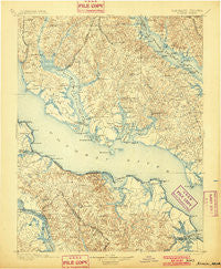
~ Nomini VA topo map, 1:125000 scale, 30 X 30 Minute, Historical, 1898, updated 1901
Nomini, Virginia, USGS topographic map dated 1898.
Includes geographic coordinates (latitude and longitude). This topographic map is suitable for hiking, camping, and exploring, or framing it as a wall map.
Printed on-demand using high resolution imagery, on heavy weight and acid free paper, or alternatively on a variety of synthetic materials.
Topos available on paper, Waterproof, Poly, or Tyvek. Usually shipping rolled, unless combined with other folded maps in one order.
- Product Number: USGS-5368668
- Free digital map download (high-resolution, GeoPDF): Nomini, Virginia (file size: 10 MB)
- Map Size: please refer to the dimensions of the GeoPDF map above
- Weight (paper map): ca. 55 grams
- Map Type: POD USGS Topographic Map
- Map Series: HTMC
- Map Verison: Historical
- Cell ID: 65240
- Scan ID: 189099
- Imprint Year: 1901
- Survey Year: 1890
- Datum: Unstated
- Map Projection: Unstated
- Map published by United States Geological Survey
- Map Language: English
- Scanner Resolution: 600 dpi
- Map Cell Name: Colonial
- Grid size: 30 X 30 Minute
- Date on map: 1898
- Map Scale: 1:125000
- Geographical region: Virginia, United States
Neighboring Maps:
All neighboring USGS topo maps are available for sale online at a variety of scales.
Spatial coverage:
Topo map Nomini, Virginia, covers the geographical area associated the following places:
- Montross - Springfield - Sexton Hill - Western Shores - West Hatton - Chapel Point Woods - Gravelly Hills - Deer Park - Morgantown - Piney Point - Harbor Hills - China Hill - Woodberry Beach - Ponderosa Estates - Neenah - Budds Creek - Newland - Newtown (historical) - Norwood - Dukes Retreat - Denby Hill - Adelina - Beverly Estates - Germans Corner - Hidden River - Briscoe - Mill Cove Manor - Britton - Yellow Bank - Ragged Point Beach - Tidwells - Holly Gaf Acres - Classic Shore - Burning Oaks - Carys Corner - Forest Glade - King-Kennedy Estates - Spring Hill (historical) - Tall Timbers - Valley Lee - Loveville - Saint George Beach - Land-O-Lakes - Fox Hill - Patterson Park - Hurry - Chaptico - Bull Run - Tucker Hill - Potomac Beach - Nomini - Ridgewood - Battle (historical) - Nostalgia - Riverwood Farms - Shady Harbor Shores - Wicomico Ridge - Long Cove Estates - Wallville Acres - Cremona - Birch Hanger - Woodland Acres - Rogers Mill - Currioman Landing - Middle Earth - Baynesville - Cypress Knolls - Erica - Red Hill - East End - Mount Holly - Fenwick Manor - Oraville - Gilbert Acres - Old Sycamore Estates - Dentsville - Birch Manor - Summerseat Village - Charlotte Hall - Latanes - Widow Woods - Indian River Estates - Breton Woods - Holly Oaks - Burnt Mill - Middletown - Champlain - Knollcrest - Parker Wharf - Bel Alton - Emerald Cove - Sandy Point - Mount Victoria - Harryhogan - Tompkinsville - Maryland Manor - Peeds - Island Creek - Mackall Estates - Scotch Point
- Map Area ID: AREA38.538-77-76.5
- Northwest corner Lat/Long code: USGSNW38.5-77
- Northeast corner Lat/Long code: USGSNE38.5-76.5
- Southwest corner Lat/Long code: USGSSW38-77
- Southeast corner Lat/Long code: USGSSE38-76.5
- Northern map edge Latitude: 38.5
- Southern map edge Latitude: 38
- Western map edge Longitude: -77
- Eastern map edge Longitude: -76.5


