
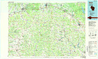
~ Sparta WI topo map, 1:100000 scale, 30 X 60 Minute, Historical, 1985, updated 1985
Sparta, Wisconsin, USGS topographic map dated 1985.
Includes geographic coordinates (latitude and longitude). This topographic map is suitable for hiking, camping, and exploring, or framing it as a wall map.
Printed on-demand using high resolution imagery, on heavy weight and acid free paper, or alternatively on a variety of synthetic materials.
Topos available on paper, Waterproof, Poly, or Tyvek. Usually shipping rolled, unless combined with other folded maps in one order.
- Product Number: USGS-5309806
- Free digital map download (high-resolution, GeoPDF): Sparta, Wisconsin (file size: 14 MB)
- Map Size: please refer to the dimensions of the GeoPDF map above
- Weight (paper map): ca. 55 grams
- Map Type: POD USGS Topographic Map
- Map Series: HTMC
- Map Verison: Historical
- Cell ID: 68393
- Scan ID: 803116
- Imprint Year: 1985
- Woodland Tint: Yes
- Aerial Photo Year: 1982
- Edit Year: 1985
- Datum: NAD27
- Map Projection: Universal Transverse Mercator
- Planimetric: Yes
- Map published by United States Geological Survey
- Map Language: English
- Scanner Resolution: 508 dpi
- Map Cell Name: Sparta
- Grid size: 30 X 60 Minute
- Date on map: 1985
- Map Scale: 1:100000
- Geographical region: Wisconsin, United States
Neighboring Maps:
All neighboring USGS topo maps are available for sale online at a variety of scales.
Spatial coverage:
Topo map Sparta, Wisconsin, covers the geographical area associated the following places:
- Tomah - Middle Ridge - Glendale - Tunnelville - Viola - Hoffman Corners - New Lisbon - Valley - Bloomingdale - Esofea - Yuba - Avalanche - Newry - Sparta - Clifton - Reedsburg - Portland - Valton - Melvina - Cashton - Oil City - Mount Tabor - Angelo - Wilton - Lemonweir - Brookville - Corwin (historical) - Dilly - Jacksonville - Union Center - Cazenovia - Bud - Wonewoc - Rockland - Westby - La Farge - Ironton - Germantown - Newberg Corners - Rockton - Norwalk - Henrietta (historical) - Springville - Hustler - Ross - Viroqua - White City - Kelly - Hillsboro - West Lima - Lone Rock - Orange Mill - Saint Marys - Raymore - Camp Douglas - Ontario - Burns - Elroy - Greenwood - Liberty - Kendall - Scotts Junction - Farmers Valley - Mauston - Trippville - Bangor - La Valle - Oakdale - Lindina - Leon
- Map Area ID: AREA4443.5-91-90
- Northwest corner Lat/Long code: USGSNW44-91
- Northeast corner Lat/Long code: USGSNE44-90
- Southwest corner Lat/Long code: USGSSW43.5-91
- Southeast corner Lat/Long code: USGSSE43.5-90
- Northern map edge Latitude: 44
- Southern map edge Latitude: 43.5
- Western map edge Longitude: -91
- Eastern map edge Longitude: -90


