
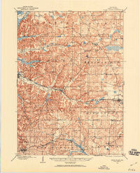
~ Cross Plains WI topo map, 1:62500 scale, 15 X 15 Minute, Historical, 1907, updated 1960
Cross Plains, Wisconsin, USGS topographic map dated 1907.
Includes geographic coordinates (latitude and longitude). This topographic map is suitable for hiking, camping, and exploring, or framing it as a wall map.
Printed on-demand using high resolution imagery, on heavy weight and acid free paper, or alternatively on a variety of synthetic materials.
Topos available on paper, Waterproof, Poly, or Tyvek. Usually shipping rolled, unless combined with other folded maps in one order.
- Product Number: USGS-5308650
- Free digital map download (high-resolution, GeoPDF): Cross Plains, Wisconsin (file size: 7 MB)
- Map Size: please refer to the dimensions of the GeoPDF map above
- Weight (paper map): ca. 55 grams
- Map Type: POD USGS Topographic Map
- Map Series: HTMC
- Map Verison: Historical
- Cell ID: 320618
- Scan ID: 801491
- Imprint Year: 1960
- Survey Year: 1907
- Datum: NAD27
- Map Projection: Polyconic
- Map published by United States Geological Survey
- Map Language: English
- Scanner Resolution: 508 dpi
- Map Cell Name: Cross Plains
- Grid size: 15 X 15 Minute
- Date on map: 1907
- Map Scale: 1:62500
- Geographical region: Wisconsin, United States
Neighboring Maps:
All neighboring USGS topo maps are available for sale online at a variety of scales.
Spatial coverage:
Topo map Cross Plains, Wisconsin, covers the geographical area associated the following places:
- Dons Mobile Manor - Lutheran Hill - Martinsville - Riley - Cross Plains - Five Points - Springfield Corners - Klevenville - Marxville - Ashton Corners - West Middleton - Middleton Junction - Black Earth - Middleton - Ashton - Aldens Corners - Roxbury - Mount Horeb - Pine Bluff
- Map Area ID: AREA43.2543-89.75-89.5
- Northwest corner Lat/Long code: USGSNW43.25-89.75
- Northeast corner Lat/Long code: USGSNE43.25-89.5
- Southwest corner Lat/Long code: USGSSW43-89.75
- Southeast corner Lat/Long code: USGSSE43-89.5
- Northern map edge Latitude: 43.25
- Southern map edge Latitude: 43
- Western map edge Longitude: -89.75
- Eastern map edge Longitude: -89.5


