
~ Black River WI topo map, 1:48000 scale, 15 X 15 Minute, Historical, 1945
Black River, Wisconsin, USGS topographic map dated 1945.
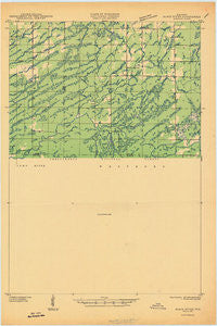
Includes geographic coordinates (latitude and longitude). This topographic map is suitable for hiking, camping, and exploring, or framing it as a wall map.
Printed on-demand using high resolution imagery, on heavy weight and acid free paper, or alternatively on a variety of synthetic materials.
Topos available on paper, Waterproof, Poly, or Tyvek. Usually shipping rolled, unless combined with other folded maps in one order.
- Product Number: USGS-5307896
- Free digital map download (high-resolution, GeoPDF): Black River, Wisconsin (file size: 4 MB)
- Map Size: please refer to the dimensions of the GeoPDF map above
- Weight (paper map): ca. 55 grams
- Map Type: POD USGS Topographic Map
- Map Series: HTMC
- Map Verison: Historical
- Cell ID: 55920
- Scan ID: 800295
- Woodland Tint: Yes
- Field Check Year: 1941
- Datum: NAD27
- Map Projection: Polyconic
- Advance: Yes
- Planimetric: Yes
- Map published by United States Geological Survey
- Map Language: English
- Scanner Resolution: 508 dpi
- Map Cell Name: Jump River Fire Tower
- Grid size: 15 X 15 Minute
- Date on map: 1945
- Map Scale: 1:48000
- Geographical region: Wisconsin, United States
Neighboring Maps:
All neighboring USGS topo maps are available for sale online at a variety of scales.
Spatial coverage:
Topo map Black River, Wisconsin, covers the geographical area associated the following places:
- Upper Steve Creek Waterfowl Area - Upper Steve Creek Flowage 9 - Fairview School (historical) - Pickerel Lake - Marsh Creek - Big Falls Campground - South Fork Jump River - Mauer Creek - North Fork Yellow River - Upper Steve Creek Flowage - 1 Reservoir - Lower Steve Creek 2WP1332 Dam - Steve Creek Flowage 35 - Lost Lake - Town of Jump River - Yellow Banks - Big Falls - Lonely Pines Airport - Jump River Fire Tower - Meadow Creek School (historical) - Mox Creek - Ice Age Trail - Steve Creek - Meadow Creek - Town of Kennan - Gilbert Creek - Hobbles Creek - Town of Hawkins - Web Creek - Ronald Winter H1876 Dam - Town Corners Wildlife Flowage E12.67 Dam - Township Corners State Wildlife Management Area - Township Corners Flowage - Kidrick Swamp - Sailor Creek - Wolf Creek - Steve Creek Flowage - Woodland School (historical) - North Fork Jump River - Steve Creek Water Fowl 2WP 1669 Dam - Red Tile School (historical) - Green Creek - South Fork Yellow River
- Map Area ID: AREA45.545.25-90.75-90.5
- Northwest corner Lat/Long code: USGSNW45.5-90.75
- Northeast corner Lat/Long code: USGSNE45.5-90.5
- Southwest corner Lat/Long code: USGSSW45.25-90.75
- Southeast corner Lat/Long code: USGSSE45.25-90.5
- Northern map edge Latitude: 45.5
- Southern map edge Latitude: 45.25
- Western map edge Longitude: -90.75
- Eastern map edge Longitude: -90.5


