
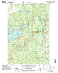
~ Upper Eau Claire Lake WI topo map, 1:24000 scale, 7.5 X 7.5 Minute, Historical, 2005, updated 2006
Upper Eau Claire Lake, Wisconsin, USGS topographic map dated 2005.
Includes geographic coordinates (latitude and longitude). This topographic map is suitable for hiking, camping, and exploring, or framing it as a wall map.
Printed on-demand using high resolution imagery, on heavy weight and acid free paper, or alternatively on a variety of synthetic materials.
Topos available on paper, Waterproof, Poly, or Tyvek. Usually shipping rolled, unless combined with other folded maps in one order.
- Product Number: USGS-5307550
- Free digital map download (high-resolution, GeoPDF): Upper Eau Claire Lake, Wisconsin (file size: 12 MB)
- Map Size: please refer to the dimensions of the GeoPDF map above
- Weight (paper map): ca. 55 grams
- Map Type: POD USGS Topographic Map
- Map Series: HTMC
- Map Verison: Historical
- Cell ID: 46407
- Scan ID: 700226
- Imprint Year: 2006
- Woodland Tint: Yes
- Aerial Photo Year: 1999
- Datum: NAD83
- Map Projection: Universal Transverse Mercator
- Map published by United States Forest Service
- Map Language: English
- Scanner Resolution: 508 dpi
- Map Cell Name: Upper Eau Claire Lake
- Grid size: 7.5 X 7.5 Minute
- Date on map: 2005
- Map Scale: 1:24000
- Geographical region: Wisconsin, United States
Neighboring Maps:
All neighboring USGS topo maps are available for sale online at a variety of scales.
Spatial coverage:
Topo map Upper Eau Claire Lake, Wisconsin, covers the geographical area associated the following places:
- Connor Lake - Birch Lake - Barnes Lake - Big Brook Lake - Bearsdale Springs Red Pine Seed Production Area - Upper Eau Claire Lake - Bearsdale Springs - Hyatt Spring - Twin Lake - Bearsdale Creek - Hall School (historical) - Mulligan Creek - Eau Claire Lakes Airport - Town of Barnes - Shunenberg Creek - Tars Creek - Henderson Lake - Sweet Lake - Robinson Lake - Shunenberg Lake - Shunenberg Springs - Devils Lake - Smith Lake - Tars Pond - Kelly Lake - Camp Lake - Pease School (historical) - Barnes School (historical)
- Map Area ID: AREA46.37546.25-91.5-91.375
- Northwest corner Lat/Long code: USGSNW46.375-91.5
- Northeast corner Lat/Long code: USGSNE46.375-91.375
- Southwest corner Lat/Long code: USGSSW46.25-91.5
- Southeast corner Lat/Long code: USGSSE46.25-91.375
- Northern map edge Latitude: 46.375
- Southern map edge Latitude: 46.25
- Western map edge Longitude: -91.5
- Eastern map edge Longitude: -91.375


