
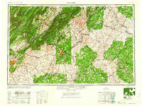
~ Roanoke VA topo map, 1:250000 scale, 1 X 2 Degree, Historical, 1959
Roanoke, Virginia, USGS topographic map dated 1959.
Includes geographic coordinates (latitude and longitude). This topographic map is suitable for hiking, camping, and exploring, or framing it as a wall map.
Printed on-demand using high resolution imagery, on heavy weight and acid free paper, or alternatively on a variety of synthetic materials.
Topos available on paper, Waterproof, Poly, or Tyvek. Usually shipping rolled, unless combined with other folded maps in one order.
- Product Number: USGS-5304222
- Free digital map download (high-resolution, GeoPDF): Roanoke, Virginia (file size: 20 MB)
- Map Size: please refer to the dimensions of the GeoPDF map above
- Weight (paper map): ca. 55 grams
- Map Type: POD USGS Topographic Map
- Map Series: HTMC
- Map Verison: Historical
- Cell ID: 74983
- Scan ID: 189260
- Woodland Tint: Yes
- Aerial Photo Year: 1944
- Datum: Unstated
- Map Projection: Transverse Mercator
- Map published by United States Geological Survey
- Map Language: English
- Scanner Resolution: 600 dpi
- Map Cell Name: Roanoke
- Grid size: 1 X 2 Degree
- Date on map: 1959
- Map Scale: 1:250000
- Geographical region: Virginia, United States
Neighboring Maps:
All neighboring USGS topo maps are available for sale online at a variety of scales.
Spatial coverage:
Topo map Roanoke, Virginia, covers the geographical area associated the following places:
- Kyles Mills - Smith Store - Greenfield - Mount Athos (historical) - Lynch Station - Greenlee - Black Rock Farm - Round Hill Terrace - Lodore - Wintergreen - James River Landing - Irby - Perth - Burnt Chimney - Northview Mobile Home Park - New London - Onan - Enderly Heights - Beech Grove - Stewardsburg - East Brook - Westbrook - Monroe - Harrington - Ashmere - Allens Creek - Fincastle - Buffalo Bend - Maple Hill - Tillmans - Abilene - Bessemer - Bellevue - Roses Mill - Madison Heights - Redwood - Allens Mill - Southwood Estates Mobile Home Park - Six Mile - Charlotte Court House - Sherwood Forest - Ashby - North Hills - Long Island - Scruggs - Roanoke - Fairfields - Poplar Flats - Charlemont - Adial - Mount Airy - Eldridge Corner - Dundee - Axtell - Intervale - Stage Junction - Pearch - Clearbrook - Dorchester Court - Helm - Moran - Lamont Acres - Healing Springs - Wilkie (historical) - Powell Corner - Fairview - Belmont Acres - Eagles Eyrie - Clevilas (historical) - Crewe - North Burlington Heights - Racy Acres - Raines Tavern - Sandusky Park - Kimberly Hills - Ballsville - Hot Springs - Guilford - Bluestone - Katrine - Esmont - Arvonia - Spring Grove - Burnette Heights - Piney River - Gladys - Moores Corner - Kingston - Malvern Hills - Four Forks - Montebello - Idlewilde - Guinea Mills - Vista Acres - Brooklawn - Bridgeport - Coolwell - Scottsville - Quail - Botetourt East
- Map Area ID: AREA3837-80-78
- Northwest corner Lat/Long code: USGSNW38-80
- Northeast corner Lat/Long code: USGSNE38-78
- Southwest corner Lat/Long code: USGSSW37-80
- Southeast corner Lat/Long code: USGSSE37-78
- Northern map edge Latitude: 38
- Southern map edge Latitude: 37
- Western map edge Longitude: -80
- Eastern map edge Longitude: -78


