
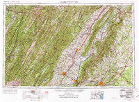
~ Charlottesville VA topo map, 1:250000 scale, 1 X 2 Degree, Historical, 1956, updated 1977
Charlottesville, Virginia, USGS topographic map dated 1956.
Includes geographic coordinates (latitude and longitude). This topographic map is suitable for hiking, camping, and exploring, or framing it as a wall map.
Printed on-demand using high resolution imagery, on heavy weight and acid free paper, or alternatively on a variety of synthetic materials.
Topos available on paper, Waterproof, Poly, or Tyvek. Usually shipping rolled, unless combined with other folded maps in one order.
- Product Number: USGS-5304196
- Free digital map download (high-resolution, GeoPDF): Charlottesville, Virginia (file size: 22 MB)
- Map Size: please refer to the dimensions of the GeoPDF map above
- Weight (paper map): ca. 55 grams
- Map Type: POD USGS Topographic Map
- Map Series: HTMC
- Map Verison: Historical
- Cell ID: 68712
- Scan ID: 189243
- Imprint Year: 1977
- Woodland Tint: Yes
- Visual Version Number: 1
- Edit Year: 1965
- Field Check Year: 1956
- Datum: Unstated
- Map Projection: Transverse Mercator
- Map published by United States Geological Survey
- Map Language: English
- Scanner Resolution: 600 dpi
- Map Cell Name: Charlottesville
- Grid size: 1 X 2 Degree
- Date on map: 1956
- Map Scale: 1:250000
- Geographical region: Virginia, United States
Neighboring Maps:
All neighboring USGS topo maps are available for sale online at a variety of scales.
Spatial coverage:
Topo map Charlottesville, Virginia, covers the geographical area associated the following places:
- Glenaire - Mount Clinton - Nida - Weese - Oakpark - Newport - Strasburg Junction - Dilleys Mill - Boston - Westover Hills - Swoope - Crozet - Brookside - O'Neal - Parkview - Christian - Lexington - Frost - Emerald Hills - Oak Flat - Laurel Hills - Stony Bottom - Mountain Grove - Ashby Heights - Commonwealth - Windsor - Peach Grove (historical) - Mustoe - Salem - Arnold Hill - Camellia Garden - Arco - Aggregates - Glenmore - Ivy Oaks - Sleepy Hollow Mobile Home Park - Ballard Woods - Pirkey - Minnehaha Springs - Willoughby - Liberty - North Mountain - Burtonville - Bowmans Crossing - Berkeley - Mayfield Trailer Court - Lyndhurst - Dale Enterprise - Massanova - Apple Mountain Lake - Masonville - Aroda - Pleasant Valley - Berkmar - Buckingham Circle - Mount Crawford - Lilly - Luray - Vanderpool - Estaline - Laurel (historical) - University Heights - Solaris - Reynard Woods - Stultz Mill - Criglersville - Weyers Cave - Cedarville - Riverton Junction - Ivy Woods - Overall - Solsburg - Viscose City - Peola Mills - Ivy - Woodland Park - Radiant - Sherwood Farms - Cutalong - Shelby - Buena - Harrisonburg - Chimney Run - Waynesboro - Monacan Town (historical) - Chestnut Grove - Milam - Forestville - Linden Heights - Springfield - Gilbert - Laneville - Hydraulic - Gordonsville - Fairview - Elkton - Burketown - Sunset (historical) - Oak Hill - Blue Grass
- Map Area ID: AREA3938-80-78
- Northwest corner Lat/Long code: USGSNW39-80
- Northeast corner Lat/Long code: USGSNE39-78
- Southwest corner Lat/Long code: USGSSW38-80
- Southeast corner Lat/Long code: USGSSE38-78
- Northern map edge Latitude: 39
- Southern map edge Latitude: 38
- Western map edge Longitude: -80
- Eastern map edge Longitude: -78


