
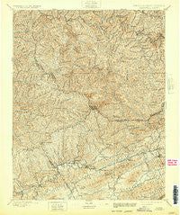
~ Tazewell VA topo map, 1:125000 scale, 30 X 30 Minute, Historical, 1897, updated 1932
Tazewell, Virginia, USGS topographic map dated 1897.
Includes geographic coordinates (latitude and longitude). This topographic map is suitable for hiking, camping, and exploring, or framing it as a wall map.
Printed on-demand using high resolution imagery, on heavy weight and acid free paper, or alternatively on a variety of synthetic materials.
Topos available on paper, Waterproof, Poly, or Tyvek. Usually shipping rolled, unless combined with other folded maps in one order.
- Product Number: USGS-5304126
- Free digital map download (high-resolution, GeoPDF): Tazewell, Virginia (file size: 11 MB)
- Map Size: please refer to the dimensions of the GeoPDF map above
- Weight (paper map): ca. 55 grams
- Map Type: POD USGS Topographic Map
- Map Series: HTMC
- Map Verison: Historical
- Cell ID: 66756
- Scan ID: 148250
- Imprint Year: 1932
- Survey Year: 1893
- Datum: Unstated
- Map Projection: Polyconic
- Map published by United States Geological Survey
- Map Language: English
- Scanner Resolution: 600 dpi
- Map Cell Name: Tazewell
- Grid size: 30 X 30 Minute
- Date on map: 1897
- Map Scale: 1:125000
- Geographical region: Virginia, United States
Neighboring Maps:
All neighboring USGS topo maps are available for sale online at a variety of scales.
Spatial coverage:
Topo map Tazewell, Virginia, covers the geographical area associated the following places:
- Wilmore - Six - Venus - Vandyke - Marine - Paintlick - Claypool Hill - Whitewood - Honaker - Lake Park - Fork Ridge - Matney - Maitland - Frog Level - Yerba - Afredton - Lomax - Lex - War - Benbow - Big Four - Panther - Joe Whites - Rockhouse - Iaeger - Mount Gate - Adria - Pucketts Store - Red Ash - Bradshaw - Dwight - Glen Burke - Patterson - River Jack - Antler - Seaboard - Van Dyke - Peapatch - Pounding Mill - Green Place - Gap Store - Kimball - Wolford - Hull - Amonate - Horsepen Cove - Alpheus - Camp Tazewell - Rourkes Gap - Welch - Hickory Junction - Blackey - Erin - Filbert - Doran - Jewell Ridge - Atwell - Height - Stony Ridge - Superior - Asberrys - Clell - Horn - Krollitz - Grimsleyville - Youngs (historical) - Keen Mountain - Twin Branch - Faraday - Rift - Bishop - Russell - Wittens Fort - Squire - Dunford Village - Sulphur Spring (historical) - Mohegan - Elbert - Shortt Gap - Horsepen - Nacols - Hix (historical) - Jed - Sandy Huff - Mouth of Laurel - Litwar - Newhall - Jackson Flats - Beartown - Lynn Spring - Warriormine - Havaco - Roderfield - Busthead - Paynesville - Johnnycake - Rockridge - Raysal - Jolo - Criggers
- Map Area ID: AREA37.537-82-81.5
- Northwest corner Lat/Long code: USGSNW37.5-82
- Northeast corner Lat/Long code: USGSNE37.5-81.5
- Southwest corner Lat/Long code: USGSSW37-82
- Southeast corner Lat/Long code: USGSSE37-81.5
- Northern map edge Latitude: 37.5
- Southern map edge Latitude: 37
- Western map edge Longitude: -82
- Eastern map edge Longitude: -81.5


