
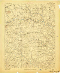
~ Spottsylvania VA topo map, 1:125000 scale, 30 X 30 Minute, Historical, 1887
Spottsylvania, Virginia, USGS topographic map dated 1887.
Includes geographic coordinates (latitude and longitude). This topographic map is suitable for hiking, camping, and exploring, or framing it as a wall map.
Printed on-demand using high resolution imagery, on heavy weight and acid free paper, or alternatively on a variety of synthetic materials.
Topos available on paper, Waterproof, Poly, or Tyvek. Usually shipping rolled, unless combined with other folded maps in one order.
- Product Number: USGS-5304104
- Free digital map download (high-resolution, GeoPDF): Spottsylvania, Virginia (file size: 6 MB)
- Map Size: please refer to the dimensions of the GeoPDF map above
- Weight (paper map): ca. 55 grams
- Map Type: POD USGS Topographic Map
- Map Series: HTMC
- Map Verison: Historical
- Cell ID: 66673
- Scan ID: 189167
- Survey Year: 1887
- Datum: Unstated
- Map Projection: Unstated
- Map published by United States Geological Survey
- Map Language: English
- Scanner Resolution: 600 dpi
- Map Cell Name: Spotsylvania
- Grid size: 30 X 30 Minute
- Date on map: 1887
- Map Scale: 1:125000
- Geographical region: Virginia, United States
Neighboring Maps:
All neighboring USGS topo maps are available for sale online at a variety of scales.
Spatial coverage:
Topo map Spottsylvania, Virginia, covers the geographical area associated the following places:
- Verdiersville - Burr Hill - England Run - Roseville Heights - Roseville Plantation - Deerfield Estates - The Preserve on Aquia Creek - Shackelford Estates - Hartwood Manor - Kellys Ford - Warrenton Center - The Cascades - Woodridge - Lignum - Laurelwood - Holly Run Estates - River Ridge Estates - Richardsville - Dunavant - Rosewood Estates - Ashburn Hills - Parkside - Wellington Chase on the Rappahannock - Brandy Hills - Mars Mobile Home Park - Mastins Corner - Foxwood Estates - Ellisville - Hartwood Meadows - Ivyglen - McHenry - Chancellor - Todds Tavern - Nora Park - Raccoon Ford - Mine Run - Mansfield Manor - Stafford Lakes Village - Crown Manor - Woodlands at Berea - Wilderness Corner - Levy - Manor Wood Estates - Dan - Smiths Mill - Holly Corners - Stubbs - Valhalla - Wares Crossroads - Childs Cove - Wallaces Corner - Lanes Corner - Lewiston - Silver Hill - Granite Springs - True Blue - Kimberly Estates - Rose Hill Farms - Cedon - Massaponax - White Owl Landing - Davis Corner - Braggs Corner - Mine Ridge - Berea Plantation - Post Oak - Nancy Wrights Corner - Panier - Country Wood Estates - Partlow - Georgetown West - Spotsylvania Courthouse - Snell - Rivergate - Ryland Corner - Indian Town - Cardinal Forest - Sumerduck - The Willows - Jones - Glendie - Alsop - Five Mile Fork - Summerset Ridge - Willowmere - Unionville - Hartwood - Barrington Woods - Queens Guard - Rosedale - Holladay - Royal Hills Estates - Concord - Amsonia - Richland Forest - Gatewood - Skyline Hills - Ribbon - Nellie Estates - Flat Run
- Map Area ID: AREA38.538-78-77.5
- Northwest corner Lat/Long code: USGSNW38.5-78
- Northeast corner Lat/Long code: USGSNE38.5-77.5
- Southwest corner Lat/Long code: USGSSW38-78
- Southeast corner Lat/Long code: USGSSE38-77.5
- Northern map edge Latitude: 38.5
- Southern map edge Latitude: 38
- Western map edge Longitude: -78
- Eastern map edge Longitude: -77.5


