
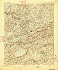
~ Pocahontas VA topo map, 1:125000 scale, 30 X 30 Minute, Historical, 1894
Pocahontas, Virginia, USGS topographic map dated 1894.
Includes geographic coordinates (latitude and longitude). This topographic map is suitable for hiking, camping, and exploring, or framing it as a wall map.
Printed on-demand using high resolution imagery, on heavy weight and acid free paper, or alternatively on a variety of synthetic materials.
Topos available on paper, Waterproof, Poly, or Tyvek. Usually shipping rolled, unless combined with other folded maps in one order.
- Product Number: USGS-5304068
- Free digital map download (high-resolution, GeoPDF): Pocahontas, Virginia (file size: 10 MB)
- Map Size: please refer to the dimensions of the GeoPDF map above
- Weight (paper map): ca. 55 grams
- Map Type: POD USGS Topographic Map
- Map Series: HTMC
- Map Verison: Historical
- Cell ID: 66359
- Scan ID: 189138
- Survey Year: 1892
- Datum: Unstated
- Map Projection: Unstated
- Map published by United States Geological Survey
- Map Language: English
- Scanner Resolution: 600 dpi
- Map Cell Name: Pocahontas
- Grid size: 30 X 30 Minute
- Date on map: 1894
- Map Scale: 1:125000
- Geographical region: Virginia, United States
Neighboring Maps:
All neighboring USGS topo maps are available for sale online at a variety of scales.
Spatial coverage:
Topo map Pocahontas, Virginia, covers the geographical area associated the following places:
- Effna - Widemouth (historical) - Dott - Godfrey - Ennis - Cove Creek - Gose Mill - Joe Neets - Maybeury - Bethel (historical) - Spanishburg - Powhatan - Benbolt - Bernietown - Hicksville - Beeson - Mud Fork - North Gap - Fourway - Burkes Garden - Weyanoke - Maple View - Springton - South Gap - Drytown - Northfork - Ceres - Princeton - Gilliam - Sam - Upland - Speedway - Black - Billie (historical) - Clark (historical) - Suiter - Saint Clair - Kegley - Big Vein - Maple Acre - Anawalt - Gardner Junction - Oak Grove - Niday - Lilly Grove - Shawver Mill - Littlesburg - Byron - Smokeless - Kale - Athens - Garwood - Coopers - Pocahontas - Ceres - Shannandale - Lake Shawnee - El Centro (historical) - Kimberling - Leckie - Ashland - Mount Olive - Matoaka - Simmons - West Graham - Crumpler - Bluefield - Piedmont - Lamar - Micajah - Wolfe - Hiawatha - Shinbrier - Ruth (historical) - Sharon Springs - Vivian - Tiptop - Crystal - Hereford - Bluewell - Pinoak - Effler - Burtons Shop - Eckman - New Hope - Kyle - Algonquin (historical) - Carnot - Cherokee - Worth - Bluestone - Wenonah - Yards - Brush Fork - Landgraff - Hardy - Glenwood - Sandlick - Five Oaks - Switchback
- Map Area ID: AREA37.537-81.5-81
- Northwest corner Lat/Long code: USGSNW37.5-81.5
- Northeast corner Lat/Long code: USGSNE37.5-81
- Southwest corner Lat/Long code: USGSSW37-81.5
- Southeast corner Lat/Long code: USGSSE37-81
- Northern map edge Latitude: 37.5
- Southern map edge Latitude: 37
- Western map edge Longitude: -81.5
- Eastern map edge Longitude: -81


