
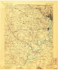
~ Mt Vernon VA topo map, 1:125000 scale, 30 X 30 Minute, Historical, 1894, updated 1907
Mt Vernon, Virginia, USGS topographic map dated 1894.
Includes geographic coordinates (latitude and longitude). This topographic map is suitable for hiking, camping, and exploring, or framing it as a wall map.
Printed on-demand using high resolution imagery, on heavy weight and acid free paper, or alternatively on a variety of synthetic materials.
Topos available on paper, Waterproof, Poly, or Tyvek. Usually shipping rolled, unless combined with other folded maps in one order.
- Product Number: USGS-5304024
- Free digital map download (high-resolution, GeoPDF): Mt Vernon, Virginia (file size: 7 MB)
- Map Size: please refer to the dimensions of the GeoPDF map above
- Weight (paper map): ca. 55 grams
- Map Type: POD USGS Topographic Map
- Map Series: HTMC
- Map Verison: Historical
- Cell ID: 320671
- Scan ID: 189082
- Imprint Year: 1907
- Survey Year: 1888
- Datum: Unstated
- Map Projection: Unstated
- Map published by United States Geological Survey
- Map Language: English
- Scanner Resolution: 600 dpi
- Map Cell Name: Mount Vernon
- Grid size: 30 X 30 Minute
- Date on map: 1894
- Map Scale: 1:125000
- Geographical region: Virginia, United States
Neighboring Maps:
All neighboring USGS topo maps are available for sale online at a variety of scales.
Spatial coverage:
Topo map Mt Vernon, Virginia, covers the geographical area associated the following places:
- Schneider Crossroads - West Springfield - Sligo - Hallmark Manor - Georgetown Heights (historical) - Dogwoods - Chevy Chase - Waldon Woods - Old Dominion Gardens - Langley Oaks - Brandon Village - Columbia Heights - Forest Hills - Indian Run Park - Perry Wright - North Takoma Park - Westmoreland Terrace - Annandale Acres - The Cloisters - Bradley Woods - Four Corners - Westwood Park - Park Place - Pine Ridge - Kimberly Knolls - Hawthorne Manor - Huntington - Gunston Manor - Bellevue Estates - Franklin Park - Graystone Estates - Walter Heights - Independent Hill - Potomac Vista - Dalecrest - Farmington Road Estates - Yorkshire Village - Truxton Circle - Warington Hills - Foxhall Village - Ellerslie Heights - Mill Creek Park - Monticello Forest - Bayside Park - Shouse Village - Canterbury Woods - Rosslyn - Colony Woods - Graham Park Shores - Floris - Eckington - Ridge Wood Estates - Malbrook - Rosemont - Penderbrook - Breeden Forest - Accokeek - Walhaven - Foxhall Terrace - Old Belle Fair (historical) - Orangedale - Broyhill Crest - Parkfairfax - Cabin John Park - Villamay - Occoquan - Reno - Springvale - Georgetown South - Tantallon North - Poplar Heights - Brookhaven - Fair Vernon - Belleair - Woodmont - Broyhill-McLean Estates - Carroll Manor - Clarks Crossing - Farrs Corner - Silver Spring Park - Winthrop (historical) - Lorton - Bon Air - Village of Mount Air - Moneys Corner - Alpine - Burleith - Colony Hill - Mockingbird Ridge - Brookville - Montyville - Bannockburn - Montclair - Ridgeview - Cloisters - Overlee Knolls - Newington - Glymont - Mill Run Acres - Monticello Park
- Map Area ID: AREA3938.5-77.5-77
- Northwest corner Lat/Long code: USGSNW39-77.5
- Northeast corner Lat/Long code: USGSNE39-77
- Southwest corner Lat/Long code: USGSSW38.5-77.5
- Southeast corner Lat/Long code: USGSSE38.5-77
- Northern map edge Latitude: 39
- Southern map edge Latitude: 38.5
- Western map edge Longitude: -77.5
- Eastern map edge Longitude: -77


