
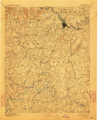
~ Lynchburg VA topo map, 1:125000 scale, 30 X 30 Minute, Historical, 1892, updated 1911
Lynchburg, Virginia, USGS topographic map dated 1892.
Includes geographic coordinates (latitude and longitude). This topographic map is suitable for hiking, camping, and exploring, or framing it as a wall map.
Printed on-demand using high resolution imagery, on heavy weight and acid free paper, or alternatively on a variety of synthetic materials.
Topos available on paper, Waterproof, Poly, or Tyvek. Usually shipping rolled, unless combined with other folded maps in one order.
- Product Number: USGS-5303992
- Free digital map download (high-resolution, GeoPDF): Lynchburg, Virginia (file size: 8 MB)
- Map Size: please refer to the dimensions of the GeoPDF map above
- Weight (paper map): ca. 55 grams
- Map Type: POD USGS Topographic Map
- Map Series: HTMC
- Map Verison: Historical
- Cell ID: 65956
- Scan ID: 189057
- Imprint Year: 1911
- Survey Year: 1890
- Datum: Unstated
- Map Projection: Unstated
- Map published by United States Geological Survey
- Map Language: English
- Scanner Resolution: 600 dpi
- Map Cell Name: Lynchburg
- Grid size: 30 X 30 Minute
- Date on map: 1892
- Map Scale: 1:125000
- Geographical region: Virginia, United States
Neighboring Maps:
All neighboring USGS topo maps are available for sale online at a variety of scales.
Spatial coverage:
Topo map Lynchburg, Virginia, covers the geographical area associated the following places:
- Gillespie - Galts Mill - Woodford Corner - Woodlands - Brights - Hill Grove - Maple Hill - Forest Dale - Oxford Furnace - Evington - Martins Store - Daniels Hill - Lawyers - Goode - Windcrest Manor - Sandusky Park - West Briar - Belmont Acres - Melwood Manor - Abert - Marysville - Seneca - Sedalia - Reusens - Diamond Hill - Sherwood Forest - Fairfields - City Farm - Forest Hill - Garland Hill - Southland Acres - Merry Moor - East Brook - Charlemont - Forest Brook Hills - Sycamore - Wright Shop - Old Stage Run - Viking Fiord - Westward Park - Powhatan - Poplar Forest - Mount Zion - Hurt - Lo Roy Acres - Seminole Ridge - Glenwood - Westbrook - Bedford Springs - Brightwell Mill - Coffee - Ruritan - Meadow Wood - Green Meadows - Landmark - College Park - Kenwood Hills - Gladys - Ivanhoe Forest - Brookville - Oakview - Holiday Acres - Locust Gardens Mobile Home Park - Tanglewood - Mitchell Mill - Jackson Heights - Centerville - Lavino Village - Curtis - Woodbine Acres - Chestnut Fork - Forest Park - Prices Store - Lynch Station - City Gomingo - Great Oaks - Fort Hill - Moseley Heights - Lakewood - Mount Athos (historical) - Long Meadows - Pine Ridge - Browntown - Motley - Deer Creek - Cedar Forest - Valley View Heights - Keystone Forest - Taber - Brandywine - Vista Acres - Black Rock Farm - Meadowview Hills - Long Island - Homestead Haven - Vista Acres - Melrose - Sleepy Hollow - Lakeview - Forest
- Map Area ID: AREA37.537-79.5-79
- Northwest corner Lat/Long code: USGSNW37.5-79.5
- Northeast corner Lat/Long code: USGSNE37.5-79
- Southwest corner Lat/Long code: USGSSW37-79.5
- Southeast corner Lat/Long code: USGSSE37-79
- Northern map edge Latitude: 37.5
- Southern map edge Latitude: 37
- Western map edge Longitude: -79.5
- Eastern map edge Longitude: -79


