
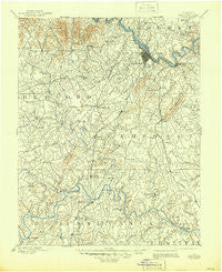
~ Lynchburg VA topo map, 1:125000 scale, 30 X 30 Minute, Historical, 1892, updated 1944
Lynchburg, Virginia, USGS topographic map dated 1892.
Includes geographic coordinates (latitude and longitude). This topographic map is suitable for hiking, camping, and exploring, or framing it as a wall map.
Printed on-demand using high resolution imagery, on heavy weight and acid free paper, or alternatively on a variety of synthetic materials.
Topos available on paper, Waterproof, Poly, or Tyvek. Usually shipping rolled, unless combined with other folded maps in one order.
- Product Number: USGS-5303986
- Free digital map download (high-resolution, GeoPDF): Lynchburg, Virginia (file size: 7 MB)
- Map Size: please refer to the dimensions of the GeoPDF map above
- Weight (paper map): ca. 55 grams
- Map Type: POD USGS Topographic Map
- Map Series: HTMC
- Map Verison: Historical
- Cell ID: 65956
- Scan ID: 188288
- Imprint Year: 1944
- Survey Year: 1890
- Datum: Unstated
- Map Projection: Unstated
- Map published by United States Geological Survey
- Map Language: English
- Scanner Resolution: 600 dpi
- Map Cell Name: Lynchburg
- Grid size: 30 X 30 Minute
- Date on map: 1892
- Map Scale: 1:125000
- Geographical region: Virginia, United States
Neighboring Maps:
All neighboring USGS topo maps are available for sale online at a variety of scales.
Spatial coverage:
Topo map Lynchburg, Virginia, covers the geographical area associated the following places:
- Westview - Hodges - Lavino Village - Fairfields - Lynch Station - Sleepy Hollow - Galts Mill - Wildwood - Woodbine Acres - Sedalia - Woodbine Village - Lowry - Sandy Acres - Forest - Brush Tavern - Three Fountains - Rainbow Forest - Coffee - Perrows - Forest Hill - Moseley Heights - Brandywine - Marysville - Ruritan - Meadowview Hills - Boonsboro - Forest Brook Hills - New London - Bocock - Melrose - Sunny Banks - Chestnut Fork - Hurt - Montrose Heights - Woodlawn - Wright Shop - Federal Hill Estates - Hill Grove - Edgewood - Perrowville - Grit - Sandy Bottom - Clay - Holly Hills South - Windcrest Manor - Gillespie - Hillsman Corner - Beverly Heights - Richland Hills - Seminole Ridge - Level Run - Diamond Hill - Closeburn Manor - Brookville - Heritage Hills - Green Hill - Curtis - Whetstone Hills - Brights - Eagles Eyrie - Belmont Acres - Doral Acres - Mitchell Mill - Forest Hill - Martins Shop - Mayfield - Pine Ridge - City Gomingo - Taber - Perkins Park - Lo Roy Acres - Lakeview - Locust Gardens Mobile Home Park - Black Rock Farm - Bluemont Estates - Woodlands - Magruder Hills - Peakland - Mount Athos (historical) - Garland Hill - Huddleston - Meadow Wood - Landmark - Gladys - Leesville - City Farm - Timberlake - Evington - Old Stage Run - Windsor Hills - Nottingham Forest - Merry Moor - Jackson Heights - Woodford Corner - Mount Zion - Seneca - Viking Fiord - Joshua Falls - Bedford Springs - Southland Acres
- Map Area ID: AREA37.537-79.5-79
- Northwest corner Lat/Long code: USGSNW37.5-79.5
- Northeast corner Lat/Long code: USGSNE37.5-79
- Southwest corner Lat/Long code: USGSSW37-79.5
- Southeast corner Lat/Long code: USGSSE37-79
- Northern map edge Latitude: 37.5
- Southern map edge Latitude: 37
- Western map edge Longitude: -79.5
- Eastern map edge Longitude: -79


