
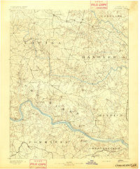
~ Goochland VA topo map, 1:125000 scale, 30 X 30 Minute, Historical, 1892
Goochland, Virginia, USGS topographic map dated 1892.
Includes geographic coordinates (latitude and longitude). This topographic map is suitable for hiking, camping, and exploring, or framing it as a wall map.
Printed on-demand using high resolution imagery, on heavy weight and acid free paper, or alternatively on a variety of synthetic materials.
Topos available on paper, Waterproof, Poly, or Tyvek. Usually shipping rolled, unless combined with other folded maps in one order.
- Product Number: USGS-5303872
- Free digital map download (high-resolution, GeoPDF): Goochland, Virginia (file size: 6 MB)
- Map Size: please refer to the dimensions of the GeoPDF map above
- Weight (paper map): ca. 55 grams
- Map Type: POD USGS Topographic Map
- Map Series: HTMC
- Map Verison: Historical
- Cell ID: 65577
- Scan ID: 188957
- Survey Year: 1888
- Datum: Unstated
- Map Projection: Unstated
- Map published by United States Geological Survey
- Map Language: English
- Scanner Resolution: 600 dpi
- Map Cell Name: Goochland
- Grid size: 30 X 30 Minute
- Date on map: 1892
- Map Scale: 1:125000
- Geographical region: Virginia, United States
Neighboring Maps:
All neighboring USGS topo maps are available for sale online at a variety of scales.
Spatial coverage:
Topo map Goochland, Virginia, covers the geographical area associated the following places:
- Mount Nebo - Cedar Fork - Centerville - Woodmont - Shady Grove - Hylas - Oak Grove Estates - Tuckahoe Village - Hadensville Estates - Vontay - Duggins Store - Coffey Corner - Aldwyck - East Leake - Shelfar - Dover Run - Fords - Old Gun - Amber Lake - Tally Ho Estates - Sweet Briar Park - Gays (historical) - Hewlett - Pendleton - Covington - Wedgewood - Green Bay - Holliday - Hermitage Hamlet - Old Bandana - Cheney Creek - Mooreland Farms - Fox Downs - Deerfield - Deep Woods - Highland Hills - Dorset Woods - Hobby Hill Farms - Holly Grove - Subletts - Dongola - Cambridge - Westlake Hills - Village Acres - Running Still - Red Lane - Crosswoods West - Macon - Tylers - Greenes Corner - Vigor - Huguenot Hills - Bellview Gardens - Manakin Farms - Goochland - Laurel Lakes - Plain View - Wayland - Sheffield Court - Chilesburg - Sabot - Westover Heights - Timber Ridge - Hunters Woods - Gardners Crossroads - Edgehill - Cuckoo - Terrell Store - Crozier - Erin Shades - Jackson - Gum Spring - West Jenningsville - Oaklands - Apple Grove - Deerwood - Pittaway Farms - Trice Subdivision - Maidens Forest - Cardwell - Beaverdam - Glenbrook Hills - Smokey Hollow - Holly Hills - Ashwoods - Spring Grove - Maidens - Lake Killarney - Grand Summit - Quioccasin - Verdon - Pagebrook - Willowbrook - Bon Air Manor - Granite - Perkinsville - Huguenot Farms - Auburn Chase - Buckingham - Samary Forest
- Map Area ID: AREA3837.5-78-77.5
- Northwest corner Lat/Long code: USGSNW38-78
- Northeast corner Lat/Long code: USGSNE38-77.5
- Southwest corner Lat/Long code: USGSSW37.5-78
- Southeast corner Lat/Long code: USGSSE37.5-77.5
- Northern map edge Latitude: 38
- Southern map edge Latitude: 37.5
- Western map edge Longitude: -78
- Eastern map edge Longitude: -77.5


