
~ Winchester VA topo map, 1:100000 scale, 30 X 60 Minute, Historical, 1983, updated 1987
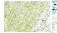
Winchester, Virginia, USGS topographic map dated 1983.
Includes geographic coordinates (latitude and longitude). This topographic map is suitable for hiking, camping, and exploring, or framing it as a wall map.
Printed on-demand using high resolution imagery, on heavy weight and acid free paper, or alternatively on a variety of synthetic materials.
Topos available on paper, Waterproof, Poly, or Tyvek. Usually shipping rolled, unless combined with other folded maps in one order.
- Product Number: USGS-5303704
- Free digital map download (high-resolution, GeoPDF): Winchester, Virginia (file size: 28 MB)
- Map Size: please refer to the dimensions of the GeoPDF map above
- Weight (paper map): ca. 55 grams
- Map Type: POD USGS Topographic Map
- Map Series: HTMC
- Map Verison: Historical
- Cell ID: 68601
- Scan ID: 188815
- Imprint Year: 1987
- Woodland Tint: Yes
- Visual Version Number: 1
- Aerial Photo Year: 1982
- Edit Year: 1983
- Datum: NAD27
- Map Projection: Universal Transverse Mercator
- Map published by United States Geological Survey
- Map Language: English
- Scanner Resolution: 600 dpi
- Map Cell Name: Winchester
- Grid size: 30 X 60 Minute
- Date on map: 1983
- Map Scale: 1:100000
- Geographical region: Virginia, United States
Neighboring Maps:
All neighboring USGS topo maps are available for sale online at a variety of scales.
Spatial coverage:
Topo map Winchester, Virginia, covers the geographical area associated the following places:
- Layside Estates - Bunker Hill - Good - Champwood - Cunningham - Yellow Spring - McCauley - Donaldson - Nero (historical) - Poplar Ridge - Wellington Acres - Gore - Country Park - Meadow - Millbrook - White Hall - Ravenwood Estates - De Haveland Estates - Grace - Waterloo Heights - Pleasantdale - Mechanicsburg - Saratoga - High View - Delray - Mapleton (historical) - Briggs - Klines Mill - North River Mills - College Park - Canterburg - Mount Williams - Country Club Estates - Burnt Factory - Sunnyside - Opequon - Hogue Creek Estates - Light (historical) - Greenwood - Cedar Hill - Keyser - Intermont - Black Oak - Oakland - Clear Brook - White Post - Baker - Inwood - Round Hill - Shanghai - Finger Lake Estates - Bloomery - Neals Run - Keeneland - Valley (historical) - Largent - Limestone - Reeses Mill - Cedar Grove - Ganotown - Grouse Hollow Estates - Hill Crest - Burlington - Greenway Estates - Arkansas - Unger - Points - Johnson - Three Churches - Raven Rocks - Heritage Hills - Rock Oak - Swimley - Stonewall Orchard - Hoy - Mosswood Hills - Bloom (historical) - Meadow Mills - Gordondale - Mount Hope - Russelldale - Millwood - Southwood Hills - Capon Springs Station (historical) - Mountain View Acres - Brookneil - Claytonville - Ash Hollow Estates - Bubbling Spring - Stephens City - Ruckman - Spring Meadows Trailer Park - Pancake - Wadesville - Mount Pleasant - Wheatfield - Sycamore - Spring Gap (historical) - Boyce - Bartonsville
- Map Area ID: AREA39.539-79-78
- Northwest corner Lat/Long code: USGSNW39.5-79
- Northeast corner Lat/Long code: USGSNE39.5-78
- Southwest corner Lat/Long code: USGSSW39-79
- Southeast corner Lat/Long code: USGSSE39-78
- Northern map edge Latitude: 39.5
- Southern map edge Latitude: 39
- Western map edge Longitude: -79
- Eastern map edge Longitude: -78


