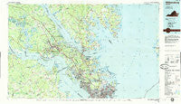
~ Williamsburg VA topo map, 1:100000 scale, 30 X 60 Minute, Historical, 1984, updated 1985
Williamsburg, Virginia, USGS topographic map dated 1984.
Includes geographic coordinates (latitude and longitude). This topographic map is suitable for hiking, camping, and exploring, or framing it as a wall map.
Printed on-demand using high resolution imagery, on heavy weight and acid free paper, or alternatively on a variety of synthetic materials.
Topos available on paper, Waterproof, Poly, or Tyvek. Usually shipping rolled, unless combined with other folded maps in one order.
- Product Number: USGS-5303700
- Free digital map download (high-resolution, GeoPDF): Williamsburg, Virginia (file size: 23 MB)
- Map Size: please refer to the dimensions of the GeoPDF map above
- Weight (paper map): ca. 55 grams
- Map Type: POD USGS Topographic Map
- Map Series: HTMC
- Map Verison: Historical
- Cell ID: 68591
- Scan ID: 188813
- Imprint Year: 1985
- Woodland Tint: Yes
- Aerial Photo Year: 1982
- Edit Year: 1984
- Datum: NAD27
- Map Projection: Universal Transverse Mercator
- Planimetric: Yes
- Map published by United States Geological Survey
- Map Language: English
- Scanner Resolution: 600 dpi
- Map Cell Name: Williamsburg
- Grid size: 30 X 60 Minute
- Date on map: 1984
- Map Scale: 1:100000
- Geographical region: Virginia, United States
Neighboring Maps:
All neighboring USGS topo maps are available for sale online at a variety of scales.
Spatial coverage:
Topo map Williamsburg, Virginia, covers the geographical area associated the following places:
- Hudgins - Willow Green - Millwood - Severn Manor - Marlbank - Sanlun Lake - Lakeside Homes - Powhatan Shores - Williamsburg - Elberon - Retz - Windsor Terrace - Wendwood - Burts - James Terrace - Williamsburg West - Wicomico Mobile Village - Achilles - Back River - Carver Court - Lynnhaven - Tidemill - Perrin - Mount Airy - Shadow - Deer Park - Skiffes Creek Annex - Blanks Store - Elmington - Chippokes - The Meadows - Kentucky Farms - Collards Mobile Home Park - Armstrong Gardens - Fitchetts - Porter Mobile Home Park - Wicomico - Fort Nonsense - Arlington - Chickahominy Haven - Moon - Shady Oaks Mobile Home Park - Chisel Run - Toano Trace - Wareham (historical) - Dixondale (historical) - Lands End - River Terrace - Eastover - Nelson Heights - Country Village - Poquoson Shores - The Mews - Sussex at Hampton - Claremont Manor - Earness - Grafton - Severn - Neva Terrace - Signpine - Sunken Meadow Beach - Laban - Edgehill - Hunters Creek - Barclay Woods - Bloxom Trailer Court - Kennon - Patricia Heights - Harwoods Mill - Haven Beach - Beechwood - Mathews - Fairview Farms - Langley Mobile Home Park - York River Pines - Poquoson - Itata - Croaker - Yorktown - Morrison - Woods Crossroads - Peary - Adams Hunt - Ewell Hall - Middletowne Farms - Holly Forks - Baileys Beach - Spring Grove - Walden - Schenck Estates - Soles - Bellamy - Pleasant Manor - Big Bethel - Cedar Grove - Circle Mobile Home Park - Buckroe Mobile Home Park - Springfield Terrace - Skimino - Fords Colony
- Map Area ID: AREA37.537-77-76
- Northwest corner Lat/Long code: USGSNW37.5-77
- Northeast corner Lat/Long code: USGSNE37.5-76
- Southwest corner Lat/Long code: USGSSW37-77
- Southeast corner Lat/Long code: USGSSE37-76
- Northern map edge Latitude: 37.5
- Southern map edge Latitude: 37
- Western map edge Longitude: -77
- Eastern map edge Longitude: -76


