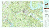
~ Fredericksburg VA topo map, 1:100000 scale, 30 X 60 Minute, Historical, 1983, updated 1984
Fredericksburg, Virginia, USGS topographic map dated 1983.
Includes geographic coordinates (latitude and longitude). This topographic map is suitable for hiking, camping, and exploring, or framing it as a wall map.
Printed on-demand using high resolution imagery, on heavy weight and acid free paper, or alternatively on a variety of synthetic materials.
Topos available on paper, Waterproof, Poly, or Tyvek. Usually shipping rolled, unless combined with other folded maps in one order.
- Product Number: USGS-5303646
- Free digital map download (high-resolution, GeoPDF): Fredericksburg, Virginia (file size: 26 MB)
- Map Size: please refer to the dimensions of the GeoPDF map above
- Weight (paper map): ca. 55 grams
- Map Type: POD USGS Topographic Map
- Map Series: HTMC
- Map Verison: Historical
- Cell ID: 67547
- Scan ID: 188785
- Imprint Year: 1984
- Woodland Tint: Yes
- Visual Version Number: 2
- Aerial Photo Year: 1977
- Edit Year: 1983
- Datum: NAD27
- Map Projection: Universal Transverse Mercator
- Map published by United States Geological Survey
- Map Language: English
- Scanner Resolution: 600 dpi
- Map Cell Name: Fredericksburg
- Grid size: 30 X 60 Minute
- Date on map: 1983
- Map Scale: 1:100000
- Geographical region: Virginia, United States
Neighboring Maps:
All neighboring USGS topo maps are available for sale online at a variety of scales.
Spatial coverage:
Topo map Fredericksburg, Virginia, covers the geographical area associated the following places:
- Berea Estates - Widewater Beach - Holly Corner Estates - Penn Manor - Somerset Landing - Bayview Estates - Montague - Heather Hills - Massaponax - Mars Mobile Home Park - Marlboro - Guinea - Hustle - Antioch Fork - Wares Crossroads - Shiloh - Panier - Glenora - Valhalla - Shady Grove Corner - Norman Estates - Allnut - Bristol (historical) - Belmont - Brookewood Estates - New London - Bend (historical) - Cannon Knolls - Hampstead Village - Foxberry - Massaponax - Rivergate - Haymount - Thornhill - Olde Forge - Smoots - Daniel Corner - Somerset Beach - Docstone Commons - Edgehill - Dunavant - Summerset Ridge - Woodland - Delos - Parkside - Water Edge Estates - Scenic Ridge - Quarry Estates - Waverly - Belle Oaks - Ribbon - Port Royal Cross Roads - Milbank - Monrovia - Woodridge - Aquia Bend - Cabin Creekwood - Midway Estates - Tylerton - Simms Landing - The Columns - Smith Hill - Pine View - Portobago - Peach Lawn - Woodleigh - Jefferson Place - Penny Corner - Greens Corner - Japazaws - Olney Corner - Butterfield - Barrett Knolls - Colonial Port - Spring Valley - Raines Corner - Ninde - Alden - Wellford Sullivan Estate - Nanjemoy - Leeland Heights - Dickinsons Corner - Argyle Hills - Stefin Woods Estate - Greenstreet Mobile Home Park - Sylvania Heights - Thornburg - Dittmeier - The Willows - Friendship Acres - Aquia Overlook - Nellie Estates - Oakridge Pointe - Bridle Lake Estates - Long Branch - Brandy Hills - Freedom Estates - Richland Forest - Kimberly Estates - Ryland Corner
- Map Area ID: AREA38.538-78-77
- Northwest corner Lat/Long code: USGSNW38.5-78
- Northeast corner Lat/Long code: USGSNE38.5-77
- Southwest corner Lat/Long code: USGSSW38-78
- Southeast corner Lat/Long code: USGSSE38-77
- Northern map edge Latitude: 38.5
- Southern map edge Latitude: 38
- Western map edge Longitude: -78
- Eastern map edge Longitude: -77


