
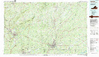
~ Danville VA topo map, 1:100000 scale, 30 X 60 Minute, Historical, 1984, updated 1984
Danville, Virginia, USGS topographic map dated 1984.
Includes geographic coordinates (latitude and longitude). This topographic map is suitable for hiking, camping, and exploring, or framing it as a wall map.
Printed on-demand using high resolution imagery, on heavy weight and acid free paper, or alternatively on a variety of synthetic materials.
Topos available on paper, Waterproof, Poly, or Tyvek. Usually shipping rolled, unless combined with other folded maps in one order.
- Product Number: USGS-5303636
- Free digital map download (high-resolution, GeoPDF): Danville, Virginia (file size: 26 MB)
- Map Size: please refer to the dimensions of the GeoPDF map above
- Weight (paper map): ca. 55 grams
- Map Type: POD USGS Topographic Map
- Map Series: HTMC
- Map Verison: Historical
- Cell ID: 67381
- Scan ID: 188779
- Imprint Year: 1984
- Woodland Tint: Yes
- Aerial Photo Year: 1978
- Edit Year: 1984
- Datum: NAD27
- Map Projection: Universal Transverse Mercator
- Map published by United States Geological Survey
- Map Language: English
- Scanner Resolution: 600 dpi
- Map Cell Name: Danville
- Grid size: 30 X 60 Minute
- Date on map: 1984
- Map Scale: 1:100000
- Geographical region: Virginia, United States
Neighboring Maps:
All neighboring USGS topo maps are available for sale online at a variety of scales.
Spatial coverage:
Topo map Danville, Virginia, covers the geographical area associated the following places:
- Rangeley - Payne - Flint Hill - Elkhorn - Whitmell - Virginia Hills - Chalk Level - Oakland - Woodlawn - Forest Hills - Hay Run - Druid Hills - Lithia Springs - Danripple - Withers Park - North Stanton - Ebenezer - Whittletown - Alchie - Pleasant Grove - Collinsville - Cedar Hill - Lumpkin Forest - Pelham - Vadens Mill - Fieldale - Swain Acres - Rickman Acres - Grady - Horse Pasture - Chatham Hills - Milton - Dundee - Brandywine Estates - Oak Hills - Green Acres - Fork Mountain - Markham - Rodden - Carlisle - Cascade - Stokesland - Rocky Mount - Major Court - Wallace Mill - Sheffield Terrace - Aiken Summit - Redeye - Providence - Cedar Park - Seminole Hills - Lucks - Turkey Fork - Pittsville - Hinesville - Pickaway - Preston - Stony Mill - Fontaine - Ajax - Ridgeway - Peytonsburg - Hopewell - Old Liberty - Glenwood - Rosa - Leaksville (historical) - High Rock - Owens Store - Keeling - Buford - Hollywood - Sonans - Koehler - Newton - Sign Rock - Jones Mill - Marrowbone Heights - Woodbury Hills - Afton Hills - Briarfield (historical) - Powell (historical) - Mount Airy - Vance - Climax - Beverstone Park - Sydnorsville - Sharon - Danville Estates - Renan - Gatewood - Grand Oaks - Fox Hollow - Galveston - Olde Hunting Hills - Creekridge - Cartersville - Chatham - Shockoe - Sherwood Forest
- Map Area ID: AREA3736.5-80-79
- Northwest corner Lat/Long code: USGSNW37-80
- Northeast corner Lat/Long code: USGSNE37-79
- Southwest corner Lat/Long code: USGSSW36.5-80
- Southeast corner Lat/Long code: USGSSE36.5-79
- Northern map edge Latitude: 37
- Southern map edge Latitude: 36.5
- Western map edge Longitude: -80
- Eastern map edge Longitude: -79


