
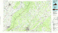
~ Charlottesville VA topo map, 1:100000 scale, 30 X 60 Minute, Historical, 1986, updated 1986
Charlottesville, Virginia, USGS topographic map dated 1986.
Includes geographic coordinates (latitude and longitude). This topographic map is suitable for hiking, camping, and exploring, or framing it as a wall map.
Printed on-demand using high resolution imagery, on heavy weight and acid free paper, or alternatively on a variety of synthetic materials.
Topos available on paper, Waterproof, Poly, or Tyvek. Usually shipping rolled, unless combined with other folded maps in one order.
- Product Number: USGS-5303630
- Free digital map download (high-resolution, GeoPDF): Charlottesville, Virginia (file size: 18 MB)
- Map Size: please refer to the dimensions of the GeoPDF map above
- Weight (paper map): ca. 55 grams
- Map Type: POD USGS Topographic Map
- Map Series: HTMC
- Map Verison: Historical
- Cell ID: 67275
- Scan ID: 188772
- Imprint Year: 1986
- Woodland Tint: Yes
- Aerial Photo Year: 1984
- Edit Year: 1986
- Datum: NAD27
- Map Projection: Universal Transverse Mercator
- Planimetric: Yes
- Map published by United States Geological Survey
- Map Language: English
- Scanner Resolution: 600 dpi
- Map Cell Name: Charlottesville
- Grid size: 30 X 60 Minute
- Date on map: 1986
- Map Scale: 1:100000
- Geographical region: Virginia, United States
Neighboring Maps:
All neighboring USGS topo maps are available for sale online at a variety of scales.
Spatial coverage:
Topo map Charlottesville, Virginia, covers the geographical area associated the following places:
- Clarkson - Greenwood - Mountain Laurel - Brinnington - Ridgewood Mobile Home Park - Dunlora Plantation - Advance Mills - Pantops - Blueridge Forest - Alderman Road Houses - Stanardsville - Stillfield - Montezuma - Stony Point - Deerwood - Almond (historical) - Dickensons Store - Northwoods Mobile Home Park - Arbor Park - Basic City - Grottoes - Hickory Ridge - Bedford Hills - Locust Grove - Barracks - Peacock Hill - Waylandsburg - Knightly - Nortonsville - North Pines - Merrimac South - Wayland Park - Charlottesville - Friendship Heights - Fieldbrook - Orchard Acres - Buena - Furnace - Upper Pocosin - Aylor - Mallard Lake - Mountfair - Milton - Cash Corner - Rugby - Sherwood Farms - Amicus - Syria - Commonwealth - Barboursville - Orange - Quinque - Fordsville - Lindsay - Cedarbrook - Meadowbrook Heights - Rotherwood - Criglersville - Trimmers Crossing - Banco - Bell Haven - Jollett - Harriston - Waynesboro - Yancey Mills - Emerald Hills - The Meadows - Verbena - Shady Grove - Summerfield - Madison Run - South Ridge (historical) - Westgate - Sleepy Hollow Mobile Home Park - Belmont Estates - Thurston - Massanetta Springs - Belmont - Inglecress - Norwood - Meriwether Hill - Liberty Mills - Locust Dale - Queen Charlotte - Jefferson Village - Melrose - Claymont Manor - Montpelier Station - Briarwood - Wilhoit (historical) - Old Somerset - Lydia - Foothill Village - Oak Hill - Burnley - Mount Crawford - Lynnwood - Dooms - Sneads Mobile Home Park - Annex
- Map Area ID: AREA38.538-79-78
- Northwest corner Lat/Long code: USGSNW38.5-79
- Northeast corner Lat/Long code: USGSNE38.5-78
- Southwest corner Lat/Long code: USGSSW38-79
- Southeast corner Lat/Long code: USGSSE38-78
- Northern map edge Latitude: 38.5
- Southern map edge Latitude: 38
- Western map edge Longitude: -79
- Eastern map edge Longitude: -78


