
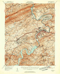
~ Radford VA topo map, 1:62500 scale, 15 X 15 Minute, Historical, 1950, updated 1952
Radford, Virginia, USGS topographic map dated 1950.
Includes geographic coordinates (latitude and longitude). This topographic map is suitable for hiking, camping, and exploring, or framing it as a wall map.
Printed on-demand using high resolution imagery, on heavy weight and acid free paper, or alternatively on a variety of synthetic materials.
Topos available on paper, Waterproof, Poly, or Tyvek. Usually shipping rolled, unless combined with other folded maps in one order.
- Product Number: USGS-5303312
- Free digital map download (high-resolution, GeoPDF): Radford, Virginia (file size: 12 MB)
- Map Size: please refer to the dimensions of the GeoPDF map above
- Weight (paper map): ca. 55 grams
- Map Type: POD USGS Topographic Map
- Map Series: HTMC
- Map Verison: Historical
- Cell ID: 61415
- Scan ID: 188512
- Imprint Year: 1952
- Aerial Photo Year: 1949
- Field Check Year: 1950
- Datum: NAD27
- Map Projection: Polyconic
- Map published by United States Geological Survey
- Map Language: English
- Scanner Resolution: 600 dpi
- Map Cell Name: Radford
- Grid size: 15 X 15 Minute
- Date on map: 1950
- Map Scale: 1:62500
- Geographical region: Virginia, United States
Neighboring Maps:
All neighboring USGS topo maps are available for sale online at a variety of scales.
Spatial coverage:
Topo map Radford, Virginia, covers the geographical area associated the following places:
- Staffordsville - Highland - Belle Heth - Wake Forest - Snowville - Churchwood (historical) - New River - Cowan - Newbern - Little Montgomery - Shiloh - Haven Heights - Burlington Mills - Walton - Highland Park - Grandview Heights - Mountain View - Hickory Hills - Fairlawn - Ridgefield - Parrott - East Radford - Poplar Hill - Smithfield - Cedar Valley - Sunset Village - Wabash (historical) - New Town - Trigg - Bear Spring - Draper - Monroe Terrace - McAdam - Simpkins Village - Belspring - Pepper - Centerville - Wurno - Dublin - Radford Village - Childress - Simpkinstown - Forest Park - Dry Branch - Highland Hills - College Park - Goodwins Ferry (historical) - Plum Creek - Springdale - Brooklyn - Willow Woods - Radford - Mill Village - McCoy - Whitethorne - Graysontown
- Map Area ID: AREA37.2537-80.75-80.5
- Northwest corner Lat/Long code: USGSNW37.25-80.75
- Northeast corner Lat/Long code: USGSNE37.25-80.5
- Southwest corner Lat/Long code: USGSSW37-80.75
- Southeast corner Lat/Long code: USGSSE37-80.5
- Northern map edge Latitude: 37.25
- Southern map edge Latitude: 37
- Western map edge Longitude: -80.75
- Eastern map edge Longitude: -80.5


