
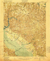
~ Morattico VA topo map, 1:62500 scale, 15 X 15 Minute, Historical, 1917
Morattico, Virginia, USGS topographic map dated 1917.
Includes geographic coordinates (latitude and longitude). This topographic map is suitable for hiking, camping, and exploring, or framing it as a wall map.
Printed on-demand using high resolution imagery, on heavy weight and acid free paper, or alternatively on a variety of synthetic materials.
Topos available on paper, Waterproof, Poly, or Tyvek. Usually shipping rolled, unless combined with other folded maps in one order.
- Product Number: USGS-5303150
- Free digital map download (high-resolution, GeoPDF): Morattico, Virginia (file size: 8 MB)
- Map Size: please refer to the dimensions of the GeoPDF map above
- Weight (paper map): ca. 55 grams
- Map Type: POD USGS Topographic Map
- Map Series: HTMC
- Map Verison: Historical
- Cell ID: 57871
- Scan ID: 188373
- Survey Year: 1917
- Datum: Unstated
- Map Projection: Unstated
- Map published by United States Army Corps of Engineers
- Map published by United States Department of War
- Map Language: English
- Scanner Resolution: 600 dpi
- Map Cell Name: Morattico
- Grid size: 15 X 15 Minute
- Date on map: 1917
- Map Scale: 1:62500
- Geographical region: Virginia, United States
Neighboring Maps:
All neighboring USGS topo maps are available for sale online at a variety of scales.
Spatial coverage:
Topo map Morattico, Virginia, covers the geographical area associated the following places:
- Pierces Corner - Lodge - Rich Neck - Moon Corner - Morattico - Totuskey - Moores Mill - Laneview - Litwalton - Emmerton - Wildwood Beach - Simons Corner - Sharps - Scotts Corner - Stately Oak - Lively - Nimcock (historical) - Butylo - Hogans Hill - Haynesville - Gibeon - Wilberts Corner - Tidewater - Bayport - Walmsley - Ivondale - Griffins Landing - Rainswood - Village - Mulch - Burtons Corner - Simonson - Oakley Landing - Luttrellville - Alfonso - Gillick Corner - Somers - Hyacinth - Walkers Corner - Fairplay - Nuttsville - Lottsburg - Dodlyt - Lara - Bridgetown (historical) - Callao - Farnham - Lyells - Robley - Threeway - Montague - Indian Field - Boer - Cobham Park - Slash - Reynolds Corner - Downings - Kennard
- Map Area ID: AREA3837.75-76.75-76.5
- Northwest corner Lat/Long code: USGSNW38-76.75
- Northeast corner Lat/Long code: USGSNE38-76.5
- Southwest corner Lat/Long code: USGSSW37.75-76.75
- Southeast corner Lat/Long code: USGSSE37.75-76.5
- Northern map edge Latitude: 38
- Southern map edge Latitude: 37.75
- Western map edge Longitude: -76.75
- Eastern map edge Longitude: -76.5


