
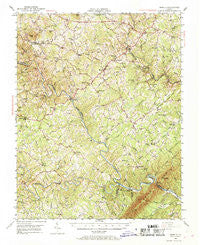
~ Moneta VA topo map, 1:62500 scale, 15 X 15 Minute, Historical, 1951, updated 1969
Moneta, Virginia, USGS topographic map dated 1951.
Includes geographic coordinates (latitude and longitude). This topographic map is suitable for hiking, camping, and exploring, or framing it as a wall map.
Printed on-demand using high resolution imagery, on heavy weight and acid free paper, or alternatively on a variety of synthetic materials.
Topos available on paper, Waterproof, Poly, or Tyvek. Usually shipping rolled, unless combined with other folded maps in one order.
- Product Number: USGS-5303134
- Free digital map download (high-resolution, GeoPDF): Moneta, Virginia (file size: 10 MB)
- Map Size: please refer to the dimensions of the GeoPDF map above
- Weight (paper map): ca. 55 grams
- Map Type: POD USGS Topographic Map
- Map Series: HTMC
- Map Verison: Historical
- Cell ID: 57778
- Scan ID: 188362
- Imprint Year: 1969
- Woodland Tint: Yes
- Aerial Photo Year: 1949
- Field Check Year: 1951
- Datum: NAD27
- Map Projection: Polyconic
- Map published by United States Geological Survey
- Map Language: English
- Scanner Resolution: 600 dpi
- Map Cell Name: Moneta
- Grid size: 15 X 15 Minute
- Date on map: 1951
- Map Scale: 1:62500
- Geographical region: Virginia, United States
Neighboring Maps:
All neighboring USGS topo maps are available for sale online at a variety of scales.
Spatial coverage:
Topo map Moneta, Virginia, covers the geographical area associated the following places:
- Eagles Roost - Lake Haven - Fancy Grove (historical) - Gross Point - Kasey - Hales Ford (historical) - Arrowhead - Isle of Pines - Clevilas (historical) - Radford - Haleford (historical) - Union Hall - White Pine - Westlake Corner - Emmaus (historical) - Smiths Paradise - Moneta - Goodview - Davis Mill - Dundee - Diamond Hill - Cape Carlyn - Scruggs - Beechwood Shores - North Shore - Crafts Point - Meador - Pelican Point - Otter View (historical) - Foxsport - The Waterfront
- Map Area ID: AREA37.2537-79.75-79.5
- Northwest corner Lat/Long code: USGSNW37.25-79.75
- Northeast corner Lat/Long code: USGSNE37.25-79.5
- Southwest corner Lat/Long code: USGSSW37-79.75
- Southeast corner Lat/Long code: USGSSE37-79.5
- Northern map edge Latitude: 37.25
- Southern map edge Latitude: 37
- Western map edge Longitude: -79.75
- Eastern map edge Longitude: -79.5


