
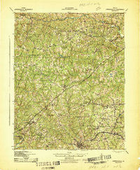
~ Lawrenceville VA topo map, 1:62500 scale, 15 X 15 Minute, Historical, 1942
Lawrenceville, Virginia, USGS topographic map dated 1942.
Includes geographic coordinates (latitude and longitude). This topographic map is suitable for hiking, camping, and exploring, or framing it as a wall map.
Printed on-demand using high resolution imagery, on heavy weight and acid free paper, or alternatively on a variety of synthetic materials.
Topos available on paper, Waterproof, Poly, or Tyvek. Usually shipping rolled, unless combined with other folded maps in one order.
- Product Number: USGS-5303020
- Free digital map download (high-resolution, GeoPDF): Lawrenceville, Virginia (file size: 9 MB)
- Map Size: please refer to the dimensions of the GeoPDF map above
- Weight (paper map): ca. 55 grams
- Map Type: POD USGS Topographic Map
- Map Series: HTMC
- Map Verison: Historical
- Cell ID: 56595
- Scan ID: 188267
- Woodland Tint: Yes
- Aerial Photo Year: 1939
- Survey Year: 1918
- Datum: NAD27
- Map Projection: Polyconic
- Map published by United States Army Corps of Engineers
- Map published by United States Department of War
- Map Language: English
- Scanner Resolution: 600 dpi
- Map Cell Name: Lawrenceville
- Grid size: 15 X 15 Minute
- Date on map: 1942
- Map Scale: 1:62500
- Geographical region: Virginia, United States
Neighboring Maps:
All neighboring USGS topo maps are available for sale online at a variety of scales.
Spatial coverage:
Topo map Lawrenceville, Virginia, covers the geographical area associated the following places:
- Champ - Alberta - Harpers - Concord - Tobacco - Octagon - Cochran - Edgerton - Cool Spring - Hickory Run - Warfield - Lawrenceville - Vote - Barrows Store - Sturgeonville - Wesson - Grandy - Edmunds Store - Danieltown - Rawlings - Bennets Crossroads - Dolphin - Price Mill - Ordsburg - Baskerville Mill - Naptha - Kress - Meredithville - Jonesboro (historical)
- Map Area ID: AREA3736.75-78-77.75
- Northwest corner Lat/Long code: USGSNW37-78
- Northeast corner Lat/Long code: USGSNE37-77.75
- Southwest corner Lat/Long code: USGSSW36.75-78
- Southeast corner Lat/Long code: USGSSE36.75-77.75
- Northern map edge Latitude: 37
- Southern map edge Latitude: 36.75
- Western map edge Longitude: -78
- Eastern map edge Longitude: -77.75


