
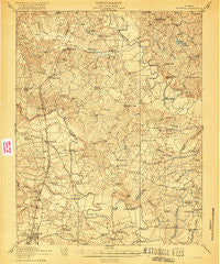
~ Doswell VA topo map, 1:62500 scale, 15 X 15 Minute, Historical, 1918
Doswell, Virginia, USGS topographic map dated 1918.
Includes geographic coordinates (latitude and longitude). This topographic map is suitable for hiking, camping, and exploring, or framing it as a wall map.
Printed on-demand using high resolution imagery, on heavy weight and acid free paper, or alternatively on a variety of synthetic materials.
Topos available on paper, Waterproof, Poly, or Tyvek. Usually shipping rolled, unless combined with other folded maps in one order.
- Product Number: USGS-5302806
- Free digital map download (high-resolution, GeoPDF): Doswell, Virginia (file size: 8 MB)
- Map Size: please refer to the dimensions of the GeoPDF map above
- Weight (paper map): ca. 55 grams
- Map Type: POD USGS Topographic Map
- Map Series: HTMC
- Map Verison: Historical
- Cell ID: 53514
- Scan ID: 188047
- Survey Year: 1918
- Datum: Unstated
- Map Projection: Unstated
- Map published by United States Army Corps of Engineers
- Map published by United States Department of War
- Map Language: English
- Scanner Resolution: 600 dpi
- Map Cell Name: Doswell
- Grid size: 15 X 15 Minute
- Date on map: 1918
- Map Scale: 1:62500
- Geographical region: Virginia, United States
Neighboring Maps:
All neighboring USGS topo maps are available for sale online at a variety of scales.
Spatial coverage:
Topo map Doswell, Virginia, covers the geographical area associated the following places:
- Reedy Mill - Etna Mills - Ashland - DeJarnette - Chenaults Shop - Chandler Crossing - Ruther Glen - Sedgefield Mobile Home Park - Caroline Pines - Doggetts Fork - Penola - Balty - Gum Tree - McDuff - Doswell - Wickham Crossing - Kemp Corner - Oak Corner - Bowersville - Blanton Crossing - Mangohick - Calno - Campbells Corner - Haleys Corner - Moncure Corner - Swans Corner - Ashland Mill - Athens - Bagdad - Signboard - Elletts Crossing - Shumansville - Kidds Fork - Patersons Corner - Hart Corner - Tuck Fork - Peatross - Wrights Fork - Covingston Corner - South Anna - Garnett Crossing - Hanover - McBryant Corner - Lorne - Keith - Colemans Mill Crossing - Taylorsville - Edgar - Campbell Corner - Burruss Corner - Little River Crossing
- Map Area ID: AREA3837.75-77.5-77.25
- Northwest corner Lat/Long code: USGSNW38-77.5
- Northeast corner Lat/Long code: USGSNE38-77.25
- Southwest corner Lat/Long code: USGSSW37.75-77.5
- Southeast corner Lat/Long code: USGSSE37.75-77.25
- Northern map edge Latitude: 38
- Southern map edge Latitude: 37.75
- Western map edge Longitude: -77.5
- Eastern map edge Longitude: -77.25


