
~ Columbia VA topo map, 1:62500 scale, 15 X 15 Minute, Historical, 1960, updated 1970
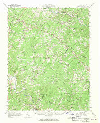
Columbia, Virginia, USGS topographic map dated 1960.
Includes geographic coordinates (latitude and longitude). This topographic map is suitable for hiking, camping, and exploring, or framing it as a wall map.
Printed on-demand using high resolution imagery, on heavy weight and acid free paper, or alternatively on a variety of synthetic materials.
Topos available on paper, Waterproof, Poly, or Tyvek. Usually shipping rolled, unless combined with other folded maps in one order.
- Product Number: USGS-5302754
- Free digital map download (high-resolution, GeoPDF): Columbia, Virginia (file size: 8 MB)
- Map Size: please refer to the dimensions of the GeoPDF map above
- Weight (paper map): ca. 55 grams
- Map Type: POD USGS Topographic Map
- Map Series: HTMC
- Map Verison: Historical
- Cell ID: 52832
- Scan ID: 187999
- Imprint Year: 1970
- Woodland Tint: Yes
- Aerial Photo Year: 1959
- Field Check Year: 1960
- Datum: NAD27
- Map Projection: Polyconic
- Map published by United States Geological Survey
- Map Language: English
- Scanner Resolution: 600 dpi
- Map Cell Name: Columbia
- Grid size: 15 X 15 Minute
- Date on map: 1960
- Map Scale: 1:62500
- Geographical region: Virginia, United States
Neighboring Maps:
All neighboring USGS topo maps are available for sale online at a variety of scales.
Spatial coverage:
Topo map Columbia, Virginia, covers the geographical area associated the following places:
- Trice (historical) - Caledonia - Tabscott East - Windsor Park - Zion Crossroads - Bells Crossroads - Royal Oaks Estates - Carysbrook - Shannon Hills - Holmhead - Zion - Hidden Acres - Bula - Shannon Hill - Troy - Tabscott - Hunters - Cloverdale - Chimney Springs - Cranks (historical) - Ferncliff - Rasawek (historical) - Mallory (historical) - Dixie - Georges Landing - Columbia - Byrd Mill - Shannon Hills Estates - Stage Junction - Quail - Dunreath (historical) - Shannon Hills Farms - Wilmington - Kents Store - Bybee - Enon
- Map Area ID: AREA3837.75-78.25-78
- Northwest corner Lat/Long code: USGSNW38-78.25
- Northeast corner Lat/Long code: USGSNE38-78
- Southwest corner Lat/Long code: USGSSW37.75-78.25
- Southeast corner Lat/Long code: USGSSE37.75-78
- Northern map edge Latitude: 38
- Southern map edge Latitude: 37.75
- Western map edge Longitude: -78.25
- Eastern map edge Longitude: -78


