
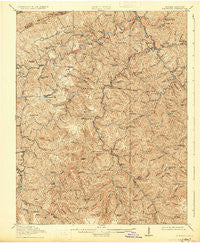
~ Clintwood VA topo map, 1:62500 scale, 15 X 15 Minute, Historical, 1915, updated 1931
Clintwood, Virginia, USGS topographic map dated 1915.
Includes geographic coordinates (latitude and longitude). This topographic map is suitable for hiking, camping, and exploring, or framing it as a wall map.
Printed on-demand using high resolution imagery, on heavy weight and acid free paper, or alternatively on a variety of synthetic materials.
Topos available on paper, Waterproof, Poly, or Tyvek. Usually shipping rolled, unless combined with other folded maps in one order.
- Product Number: USGS-5302738
- Free digital map download (high-resolution, GeoPDF): Clintwood, Virginia (file size: 12 MB)
- Map Size: please refer to the dimensions of the GeoPDF map above
- Weight (paper map): ca. 55 grams
- Map Type: POD USGS Topographic Map
- Map Series: HTMC
- Map Verison: Historical
- Cell ID: 52706
- Scan ID: 187987
- Imprint Year: 1931
- Survey Year: 1913
- Datum: NAD
- Map Projection: Polyconic
- Map published by United States Geological Survey
- Map Language: English
- Scanner Resolution: 600 dpi
- Map Cell Name: Clintwood
- Grid size: 15 X 15 Minute
- Date on map: 1915
- Map Scale: 1:62500
- Geographical region: Virginia, United States
Neighboring Maps:
All neighboring USGS topo maps are available for sale online at a variety of scales.
Spatial coverage:
Topo map Clintwood, Virginia, covers the geographical area associated the following places:
- Nealy Ridge - Freeling - Isom - Clintwood - Skeetrock - Tivis - Aily - Huckleberry (historical) - Tarpon - Ramsey Flats - Millard - Nancy - Tandy - Omaha - Haysi - Lockhart Flats - Nora - Flat Top - Dwale - Tenso - Fremont - Debusk (historical) - Birchleaf - Leck - Stratton - Lyons - Ibex (historical) - Trammel - Open Fork - Delano - Blowing Rock - Darwin - Alka (historical) - Wakenva - Longfork - Ramsey (historical) - Clinchco - McClure - Georges Fork - Foraker - Smith Corners - Flemingtown - Steinman - Bartlick - Mart
- Map Area ID: AREA37.2537-82.5-82.25
- Northwest corner Lat/Long code: USGSNW37.25-82.5
- Northeast corner Lat/Long code: USGSNE37.25-82.25
- Southwest corner Lat/Long code: USGSSW37-82.5
- Southeast corner Lat/Long code: USGSSE37-82.25
- Northern map edge Latitude: 37.25
- Southern map edge Latitude: 37
- Western map edge Longitude: -82.5
- Eastern map edge Longitude: -82.25


