
~ Carterton VA topo map, 1:62500 scale, 15 X 15 Minute, Historical, 1918
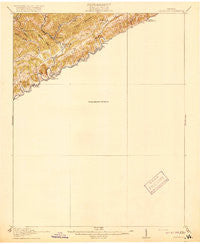
Carterton, Virginia, USGS topographic map dated 1918.
Includes geographic coordinates (latitude and longitude). This topographic map is suitable for hiking, camping, and exploring, or framing it as a wall map.
Printed on-demand using high resolution imagery, on heavy weight and acid free paper, or alternatively on a variety of synthetic materials.
Topos available on paper, Waterproof, Poly, or Tyvek. Usually shipping rolled, unless combined with other folded maps in one order.
- Product Number: USGS-5302674
- Free digital map download (high-resolution, GeoPDF): Carterton, Virginia (file size: 4 MB)
- Map Size: please refer to the dimensions of the GeoPDF map above
- Weight (paper map): ca. 55 grams
- Map Type: POD USGS Topographic Map
- Map Series: HTMC
- Map Verison: Historical
- Cell ID: 52224
- Scan ID: 187930
- Woodland Tint: Yes
- Survey Year: 1915
- Datum: Unstated
- Map Projection: Unstated
- Preliminary map: Yes
- Map published by United States Geological Survey
- Map Language: English
- Scanner Resolution: 600 dpi
- Map Cell Name: Carterton
- Grid size: 15 X 15 Minute
- Date on map: 1918
- Map Scale: 1:62500
- Geographical region: Virginia, United States
Neighboring Maps:
All neighboring USGS topo maps are available for sale online at a variety of scales.
Spatial coverage:
Topo map Carterton, Virginia, covers the geographical area associated the following places:
- Zenobia - Stone Bruise - Holston - Church Hill - Creswell - Dickensonville - Purcell - Willis - Spring City - Slabtown - Hawkins Mill - Coulwood - Artrip - South Clinchfield - Pondtown - Nash Ford - Hansonville - Barnett - Fullers - Gravel Lick - Clinchfield - Corner - Dickenson Corner - Mongle Spring - Carterton - Roebuck - Candler - Grizzle (historical) - Carbo - Counts - Bolton - Lebanon - Head of Linefork (historical) - Jessees Mill - Cleveland - The Cross Roads - Alum Wells - Willow Springs - Brumley Gap - Parsonage - Kiser (historical)
- Map Area ID: AREA3736.75-82.25-82
- Northwest corner Lat/Long code: USGSNW37-82.25
- Northeast corner Lat/Long code: USGSNE37-82
- Southwest corner Lat/Long code: USGSSW36.75-82.25
- Southeast corner Lat/Long code: USGSSE36.75-82
- Northern map edge Latitude: 37
- Southern map edge Latitude: 36.75
- Western map edge Longitude: -82.25
- Eastern map edge Longitude: -82


