
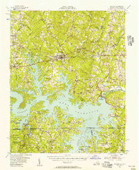
~ Boydton VA topo map, 1:62500 scale, 15 X 15 Minute, Historical, 1955, updated 1957
Boydton, Virginia, USGS topographic map dated 1955.
Includes geographic coordinates (latitude and longitude). This topographic map is suitable for hiking, camping, and exploring, or framing it as a wall map.
Printed on-demand using high resolution imagery, on heavy weight and acid free paper, or alternatively on a variety of synthetic materials.
Topos available on paper, Waterproof, Poly, or Tyvek. Usually shipping rolled, unless combined with other folded maps in one order.
- Product Number: USGS-5302604
- Free digital map download (high-resolution, GeoPDF): Boydton, Virginia (file size: 8 MB)
- Map Size: please refer to the dimensions of the GeoPDF map above
- Weight (paper map): ca. 55 grams
- Map Type: POD USGS Topographic Map
- Map Series: HTMC
- Map Verison: Historical
- Cell ID: 51699
- Scan ID: 187844
- Imprint Year: 1957
- Woodland Tint: Yes
- Aerial Photo Year: 1954
- Field Check Year: 1955
- Datum: NAD27
- Map Projection: Polyconic
- Map published by United States Geological Survey
- Map Language: English
- Scanner Resolution: 600 dpi
- Map Cell Name: Boydton
- Grid size: 15 X 15 Minute
- Date on map: 1955
- Map Scale: 1:62500
- Geographical region: Virginia, United States
Neighboring Maps:
All neighboring USGS topo maps are available for sale online at a variety of scales.
Spatial coverage:
Topo map Boydton, Virginia, covers the geographical area associated the following places:
- Dodson Corner - Baskerville - Tungsten - Midway - Dunns Corner - Rogers Corner - Callahans Corner - Phillis - Cusco Willa - Boydton - Whits Point - Finchley - Newmans - Wilson Fork - Haskinton (historical) - Eppes Fork - Gills - Presbyterian Point - Rose Hill - Skipwith - Woodworth - Muck Cross - Ponderosa - Keats - Norvello - The Ridge - Greenfield - Richardson - Gordon Corner - Castle Heights - Elamtown - Antlers
- Map Area ID: AREA36.7536.5-78.5-78.25
- Northwest corner Lat/Long code: USGSNW36.75-78.5
- Northeast corner Lat/Long code: USGSNE36.75-78.25
- Southwest corner Lat/Long code: USGSSW36.5-78.5
- Southeast corner Lat/Long code: USGSSE36.5-78.25
- Northern map edge Latitude: 36.75
- Southern map edge Latitude: 36.5
- Western map edge Longitude: -78.5
- Eastern map edge Longitude: -78.25


