
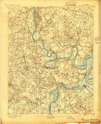
~ Bermuda Hundred VA topo map, 1:62500 scale, 15 X 15 Minute, Historical, 1894
Bermuda Hundred, Virginia, USGS topographic map dated 1894.
Includes geographic coordinates (latitude and longitude). This topographic map is suitable for hiking, camping, and exploring, or framing it as a wall map.
Printed on-demand using high resolution imagery, on heavy weight and acid free paper, or alternatively on a variety of synthetic materials.
Topos available on paper, Waterproof, Poly, or Tyvek. Usually shipping rolled, unless combined with other folded maps in one order.
- Product Number: USGS-5302568
- Free digital map download (high-resolution, GeoPDF): Bermuda Hundred, Virginia (file size: 7 MB)
- Map Size: please refer to the dimensions of the GeoPDF map above
- Weight (paper map): ca. 55 grams
- Map Type: POD USGS Topographic Map
- Map Series: HTMC
- Map Verison: Historical
- Cell ID: 51245
- Scan ID: 187809
- Survey Year: 1892
- Datum: Unstated
- Map Projection: Unstated
- Map published by United States Geological Survey
- Map Language: English
- Scanner Resolution: 600 dpi
- Map Cell Name: Bermuda Hundred
- Grid size: 15 X 15 Minute
- Date on map: 1894
- Map Scale: 1:62500
- Geographical region: Virginia, United States
Neighboring Maps:
All neighboring USGS topo maps are available for sale online at a variety of scales.
Spatial coverage:
Topo map Bermuda Hundred, Virginia, covers the geographical area associated the following places:
- Highland Park - Red Hill Mobile Home Park - Perkinson Heights - Afton - Appomattoc (historical) - Hunting Creek Hills - Piney Knolls - Kenwood - Bellmeade - Tinsberry Trace - Varina - City Point (historical) - Capitol View - Dorchester - Oakland - Bellwood Manor - Cameron Hills - Locust Grove - Varina Farm - Bensley - Sherman Park - Ocre (historical) - Glebe Point - Bellwood Estates - Gay Farms - Chesterbrook Farms - Centralia Gardens - Williamson Farms - Chimney Corner - Varina Place - Felipos Mobile Court - The Mews - Chesswood - Bryan Ridge - Jean Court - Irwin Manor - Indian Springs - Manchester Mill - Greenbriar - Bellwood - Fort Lee - Varina Grove - Dunlop - Woodvale - Meadowbrook - Hopewell - Beulah Village - Woodlawn - Nimitz Trailer Park - Cherry Gardens - Carver Homes - Hidden Valley Estates - Cotman (historical) - Autumn Oaks - Lost Forest - Lakeview - Chesterfield Court - Quail Oaks - Broad Rock Manor - Lora Lynn Heights - Crescent Park - Darbytown Estates - Pickadat Corner - Bermuda Place - Walmsley Village - Ampt Hill - Cedar Level - Lakewood Estates - Riverdale Mobile Home Park - Warwick Mobile Home Park - Ampthill Heights - Brittonwood - Osbornes (historical) - Brentwood - Salem Woods - Windsor Hills - Cedar Farms - Upper Shirley - Kendale - Pineland - Arlington - Whitlock Estates - Turner Woods - Worsham Trailer Park - Meadowville - Mistwood Forest - Patromdale - Enon - Edenshire - Courthouse Green - Sherwood Hills - Braebrook Village - Rivermont - Newstead Farm - Centralia - Beulah - Drewrys Bluff - Deep Bottom - Stratford Woods - Fair Hill
- Map Area ID: AREA37.537.25-77.5-77.25
- Northwest corner Lat/Long code: USGSNW37.5-77.5
- Northeast corner Lat/Long code: USGSNE37.5-77.25
- Southwest corner Lat/Long code: USGSSW37.25-77.5
- Southeast corner Lat/Long code: USGSSE37.25-77.25
- Northern map edge Latitude: 37.5
- Southern map edge Latitude: 37.25
- Western map edge Longitude: -77.5
- Eastern map edge Longitude: -77.25


