
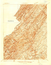
~ Middletown VA topo map, 1:48000 scale, 15 X 15 Minute, Historical, 1937
Middletown, Virginia, USGS topographic map dated 1937.
Includes geographic coordinates (latitude and longitude). This topographic map is suitable for hiking, camping, and exploring, or framing it as a wall map.
Printed on-demand using high resolution imagery, on heavy weight and acid free paper, or alternatively on a variety of synthetic materials.
Topos available on paper, Waterproof, Poly, or Tyvek. Usually shipping rolled, unless combined with other folded maps in one order.
- Product Number: USGS-5302512
- Free digital map download (high-resolution, GeoPDF): Middletown, Virginia (file size: 14 MB)
- Map Size: please refer to the dimensions of the GeoPDF map above
- Weight (paper map): ca. 55 grams
- Map Type: POD USGS Topographic Map
- Map Series: HTMC
- Map Verison: Historical
- Cell ID: 57596
- Scan ID: 187717
- Survey Year: 1937
- Datum: NAD27
- Map Projection: Polyconic
- Advance: Yes
- Map published by United States Geological Survey
- Keywords: Nonstandard Press Run
- Map Language: English
- Scanner Resolution: 600 dpi
- Map Cell Name: Middleton
- Grid size: 15 X 15 Minute
- Date on map: 1937
- Map Scale: 1:48000
- Geographical region: Virginia, United States
Neighboring Maps:
All neighboring USGS topo maps are available for sale online at a variety of scales.
Spatial coverage:
Topo map Middletown, Virginia, covers the geographical area associated the following places:
- McQuire - Devland Estates - Middletown - Meadow Mills - Clary - Indian Lake - Mount Pleasant - Oranda - Nero (historical) - Zepp - Shiloh (historical) - Rosenberger - Shawnee Land - Hunters Valley - Lebanon Church - Capon Springs - North Mountain Estates - Hayfield - Poplar Ridge - Mount Williams - Lincoln Estates - Hogue Creek Estates - Rock Enon Springs - Cabaniss - Nieswanders Fort - Mount Hope - Bloom (historical) - Jericho (historical) - Cedar Creek Battlefield - High View Manor - Wilde Acres - Paxton Hills - High View - Rock Enon - Mountain Falls Park - Gravel Springs - Layside Estates - Hooks Mills - Marlboro - Zeiger - Mountain Falls - Indian Hollow - Finger Lake Estates - Wheatfield - Stephens Fort - Lehew
- Map Area ID: AREA39.2539-78.5-78.25
- Northwest corner Lat/Long code: USGSNW39.25-78.5
- Northeast corner Lat/Long code: USGSNE39.25-78.25
- Southwest corner Lat/Long code: USGSSW39-78.5
- Southeast corner Lat/Long code: USGSSE39-78.25
- Northern map edge Latitude: 39.25
- Southern map edge Latitude: 39
- Western map edge Longitude: -78.5
- Eastern map edge Longitude: -78.25


